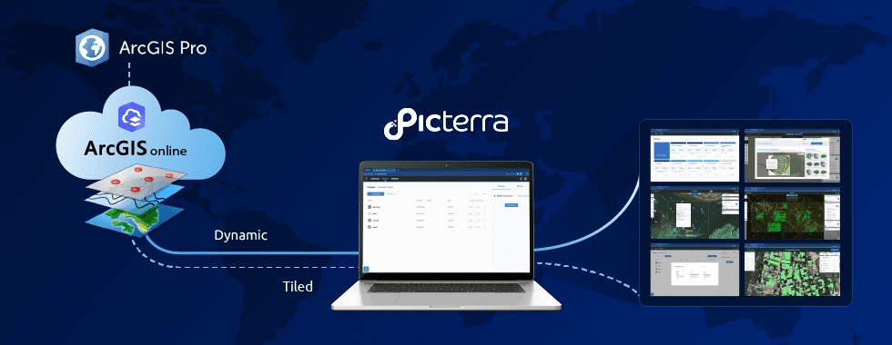

ArcGIS is a geographic information system (GIS) for working with maps and geographic information. Developed by Esri over 20 years ago, it is widely used for creating maps, analyzing mapped information, managing geographic information, compiling geographic data, and finally sharing and discovering geographic information.
Our new integration allows you to detect objects and patterns with machine learning without leaving ArcGIS – it perfectly integrates with the workflow.
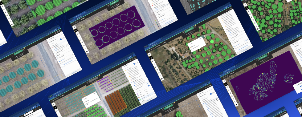
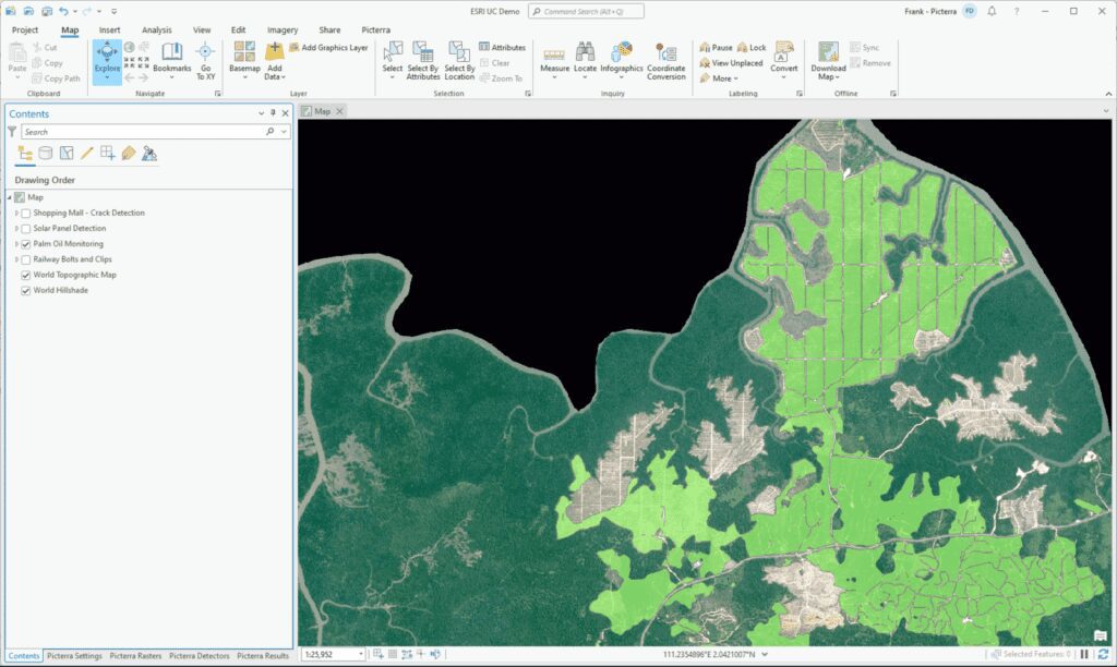
Picterra is a web platform that leverages AI to put object detection and image segmentation on geospatial imagery at your fingertips. But as an ArcGIS Pro user, you may not want to switch between tools multiple times a day, and (rightly so) prefer to be able to do everything within your GIS software. This is the reason why we’ve developed the ArcGIS integration for Picterra. Users simply need to install the integration to access all of Picterra’s functionality within ArcGIS Pro. Raster pre-processing, annotating, training, detecting and post-processing results: all of that is made possible by the add-in. Read below for how to get started.
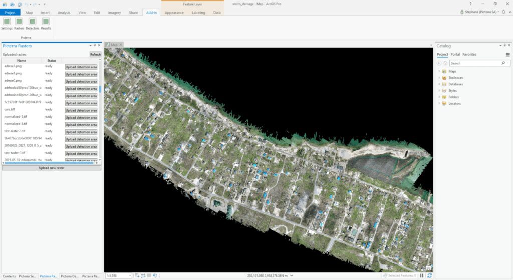
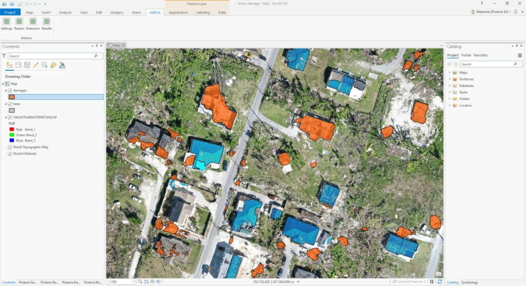
To illustrate this, we have loaded up our “Storm Damage” project in ArcGIS Pro, where we want to quantify the damage caused by a tropical storm on a Bahamian island.
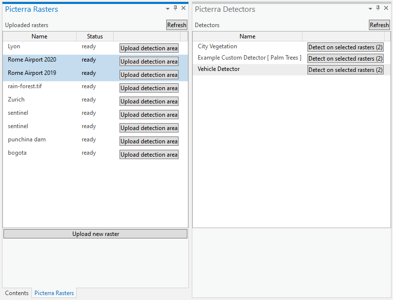
Structural damages will be identified in two different ways: tarps, which are likely used to protect broken roofs, and rubbles. After creating and training these two detectors, we ran them and added the results directly to ArcGIS, without leaving it.
Make sure to check out the integration and give us your feedback. The integration is in continual development, so we would be happy to hear from you!
The Picterra – ArcGIS integration is available for ArcGIS Pro 2.5 in the form of an add-in, which can be downloaded here.
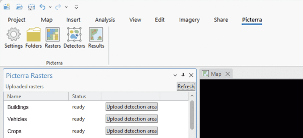
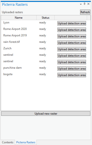
With your settings saved, head over to the “Rasters” pane to view a list of all your uploaded rasters.
Hit the “Upload new raster” button to select a file on your computer and start uploading it. It will be uploaded on your account inside the “Picterra API folder”.
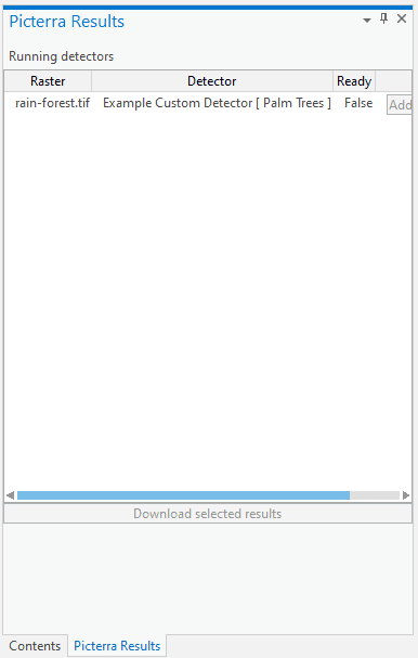
When the detection completes, hit the “Add to map” button to download the resulting shapefile and add it to your active map view (note that you can only do this if you have an active map).
The plugin is in continual development as we work to make it more useful for ArcGIS users, so we would be happy to hear your feedback! Get it here and let us know what you think!