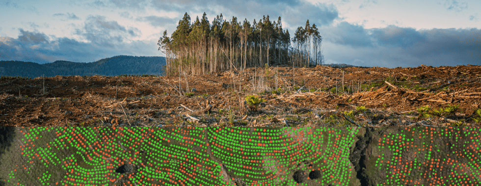
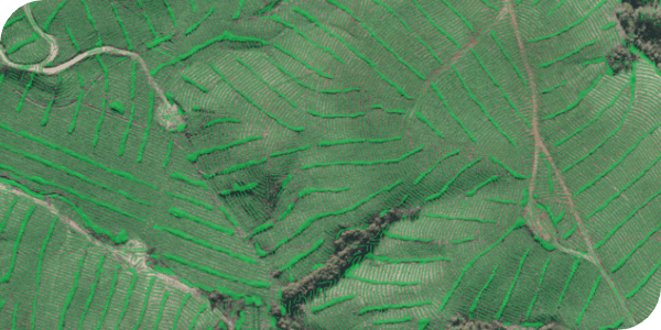
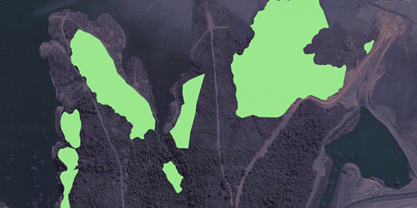
Forestry & carbon markets

Geospatial machine learning in forestry & carbon markets

Tackling forestry challenges with Picterra

Forestry management

Driving operational efficiency
Picterra's platform streamlines forest management, optimizing asset management, and enabling real-time monitoring of forest health. Make data-driven decisions for a sustainable and thriving ecosystem. Simplify your forest inventory's lifecycle across the value chain with our comprehensive solutions.

Forestry monitoring

Mitigating risks and assessing disturbance factors
Ensuring the safety and well-being of workers and communities from risky mining operations is always a top priority. Picterra’s geospatial analytics helps you identify safety hazards and minimize the risk of accidents and fatalities.

Balancing profitability and long-term stewardship

Picterra's geospatial AI technology empowers companies, governments, and organizations to balance profitability and sustainability. Identify degraded areas for restoration, allocate resources strategically for reforestation, and monitor supply chains to prevent deforestation. Contribute to sustainable practices and secure a thriving ecosystem with Picterra's advanced solutions.

Application areas

From sourcing raw materials to preventing deforestation, monitoring carbon stocks, and preserving biodiversity, sustainable forest management is crucial. Given their vast scale, forests are ideal for geospatial machine learning applications. With Picterra, you can efficiently manage forest assets and inventory remotely and at scale. Monitor every stage of the forestry cycle and promptly identify deforestation or illegal activities.

Efficient forestry cycle management

From post-harvest activities to soil preparation, plantation establishment, survival rate assessment, and weed control.

Forest disturbance and change detection

Enable swift identification of illegal logging, encroachment, disaster impact assessment, and effective mitigation planning for sustainable forest management.

Carbon stock monitoring and carbon credits sequestration

Monitor reforestation efforts and calculate the amount of carbon stored in new forests, ensuring transparency and credibility in the carbon market.

Comprehensive forest health monitoring

Enable effective detection and management of invasive species, infestations, precise land cover and classification assessments, and continuous biodiversity monitoring.

De/re-forestation monitoring and reporting

Facilitate accurate and timely assessment of forest cover changes and their environmental impact, identifying hotspots for immediate conservation efforts.

Biodiversity monitoring

Monitor the diversity of ecosystems within forests, identifying habitat types, vegetation patterns, and species distributions to inform land management strategies and support biodiversity conservation goals.

Our technology

With Picterra’s no-code platform, you can autonomously build geospatial AI models at scale up to 95% faster, driving operational efficiency in forest management and monitoring.

Tree counting

Tree counting

Sapling detection and survival rate monitoring

Sapling detection and survival rate monitoring

Soil preparation and planting hole monitoring

Soil preparation and planting hole monitoring

Plantation line monitoring

Plantation line monitoring

Weed detection, mapping, and classification

Weed detection, mapping, and classification

Invasive species detection

Invasive species detection

Land mapping and classification

Land mapping and classification

Illegal logging

Illegal logging

De and re-forestation change detection

De/re-forestation change detection

Use cases

Discover how forestry sector benefits from geospatial machine learning

EUDR compliance

Get ahead of the game with EUDR compliance

Leverage Picterra’s geospatial AI for proactive EUDR risk assessment

Start using Picterra

Discover our flexible plans that scale with your business

Blog