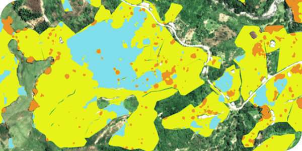
Supply chain mapping and data digitization
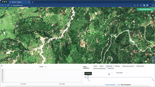
Streamline the process of obtaining precise geolocation data, simplifying its complexity. Our platform facilitates crop mapping and classification, the digitization of sourcing plots intermediate storage sites or processing facilities, points coordinates to polygons assessments. Additionally, we conduct thorough data quality verification, ensuring accuracy and reliability. With Picterra, you can effortlessly create a comprehensive digital footprint for your supply chain.

Data quality verification
We understand the importance of data quality assessment and verification in ensuring the accuracy and reliability of spatial data. Our rigorous process involves meticulous testing of each data point, including GPS points and polygons utilizing over 30 meticulously calibrated stress tests, to ensure compliance with regulatory standards and precision in the due diligence process. Moreover, as suppliers contribute updates to the database, we conduct thorough verifications, cleaning, and maintenance activities to uphold a consistently high-quality database. With Picterra, you can trust in the reliability of your spatial data. Learn more

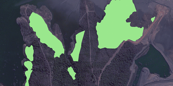
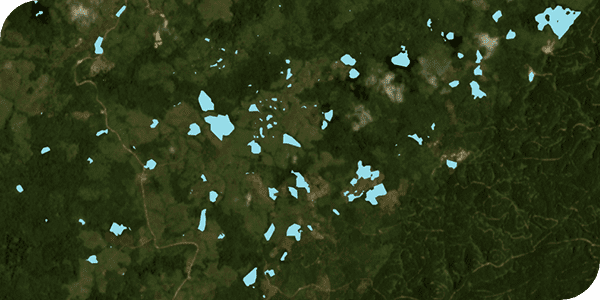
EUDR deforestation risk assessment
Picterra leads the way in EUDR compliance by blending state-of-the-art geospatial AI with a user-centric platform. Our solution offers tailored, comprehensive supply chain monitoring and deforestation risk assessment, from supplier data aggregation and quality verification to detailed deforestation risk analysis. We combine layers of relevant datasets to ensure a thorough understanding of land use changes and use high-resolution imagery and customized machine learning models where more in-depth audit is needed ensuring transparency and auditability of every step of the due diligence process.
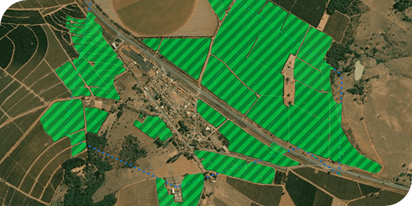
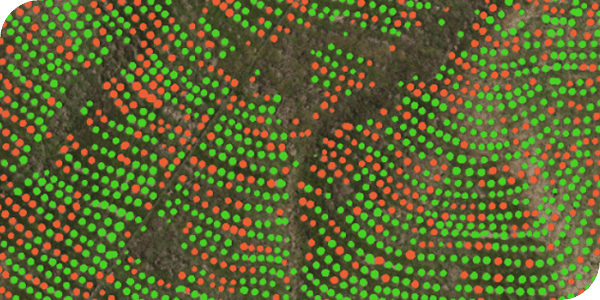
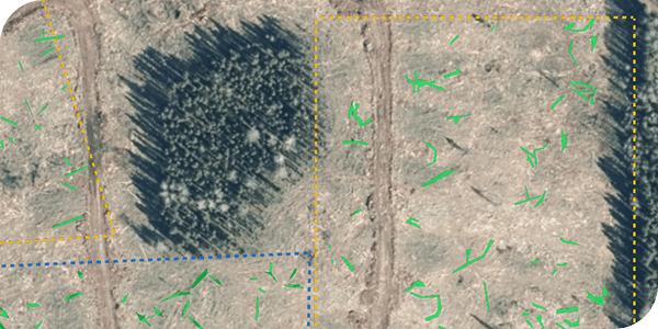
Precision monitoring of sustainable agricultural practices
Picterra's solution offers precise mapping and monitoring capabilities tailored for coffee, cocoa, and other commodity farming practices. Environmentally friendly and biodiversity-protecting agricultural methods, ensure responsibly and sustainably produced end products while preserving biodiversity and preventing land degradation. Through remote imagery and Picterra's geospatial platform and models, practices such as regenerative farming, cultivation techniques to sustain soil quality, agroforestry with shade trees, and weed control are visualized with precision and scalability. This allows for regular monitoring, contributing to the long-term sustainability of agricultural landscapes.

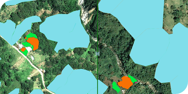
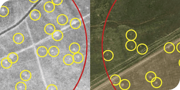
Monitoring carbon removal initiatives
The commodities industry is proactively involved in reforestation and other carbon removal/balancing initiatives to benefit the environment and mitigate their impact on climate change. Our solution for monitoring carbon removal initiatives includes for example precise mapping and tracking of tree planting efforts and their growth, including mortality/survival rates. By providing accurate spatial data insights, we enable effective on-the-ground operations, transitioning from point-based to polygon-based monitoring for real impact.

Parcels mapping and digitalization
Crops growth and resilience monitoring
Timber harvest plots monitoring
Tree cover - Shade trees and trees diversity classification
Cover crops monitoring
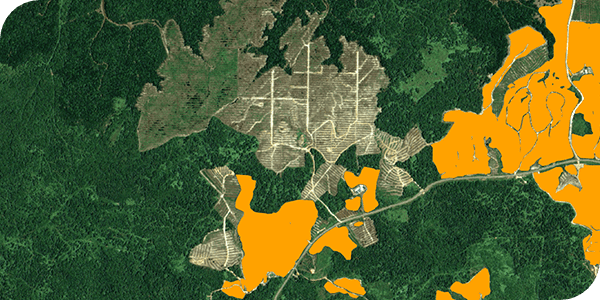
Deforestation assessment for sourcing locations
Biodiversity KPIs monitoring
Endangered species monitoring

ESG impact monitoring for sustainable supply chains
Stay on track with your ESG goals by monitoring your supplier network, tracking reforestation progress & getting alerts of non-compliant practices.
Explore the project 
Close the gap between statement and reality
Most ESG KPIs are self-reported and unsupported by data, making them difficult for regulators, investors, and other stakeholders to evaluate. With Picterra, clients can report on sustainability, social justice, and other good business indicators with trustworthy geospatial intelligence.
Explore the project