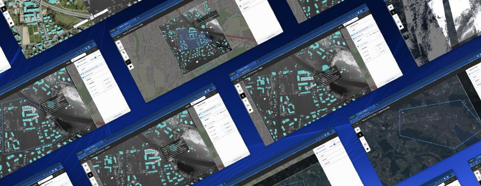
Lausanne, Switzerland, October 23, 2023 – Picterra, the leading provider of geospatial AI enterprise software, today announced the latest upgrades within the Picterra platform, designed to refine and streamline the process of creating, editing, and managing detector insights and results.
Today, we’re rolling out a number of improvements to our product to improve the efficiency of our customers. Here is what’s new:
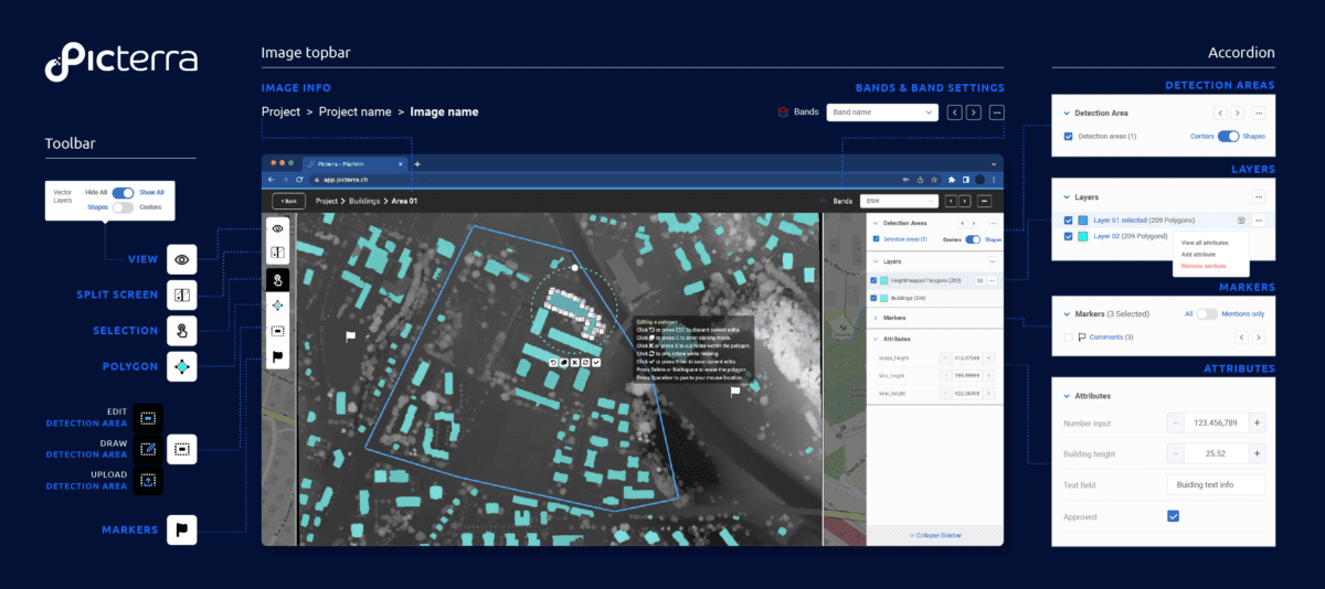
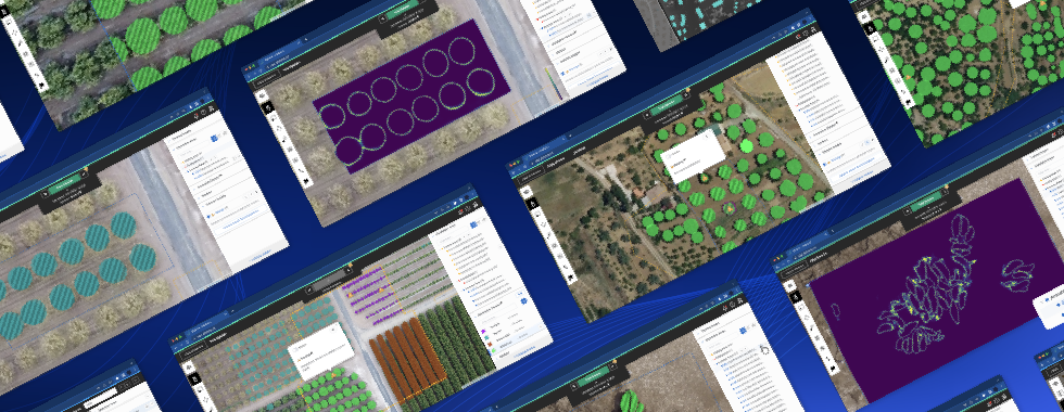
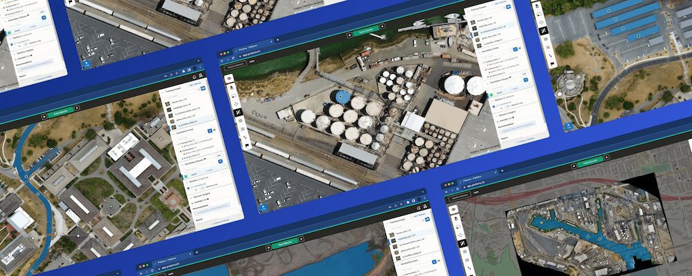
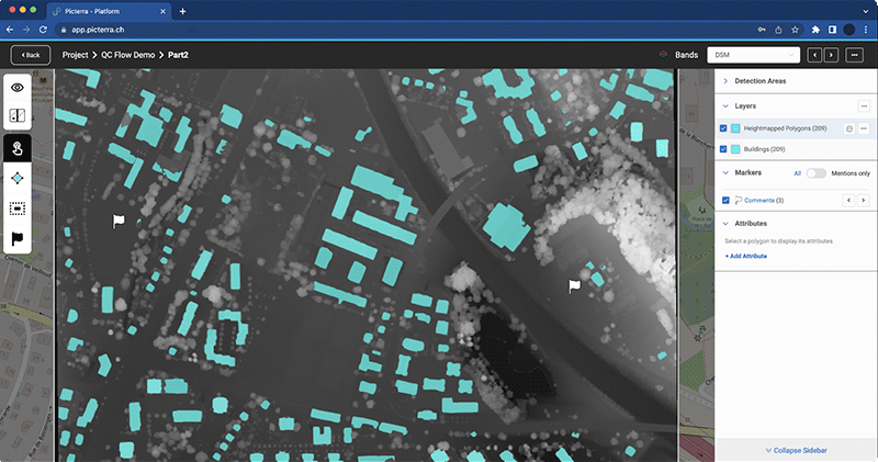
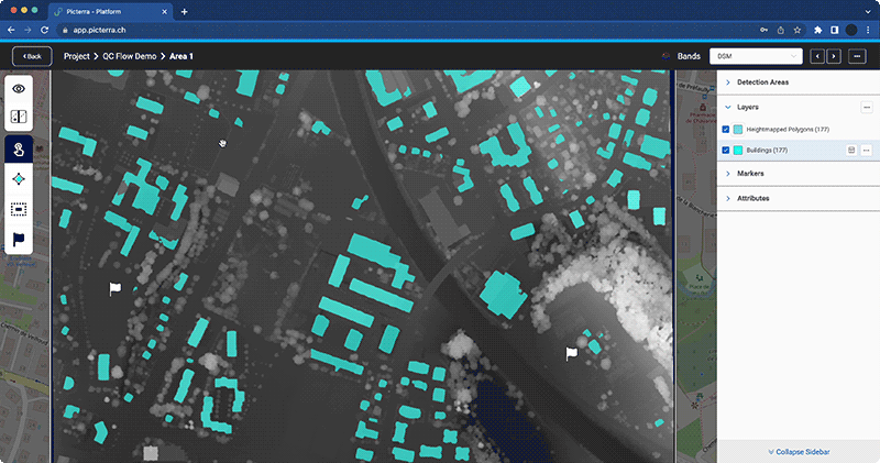
1. Refined detection areas management
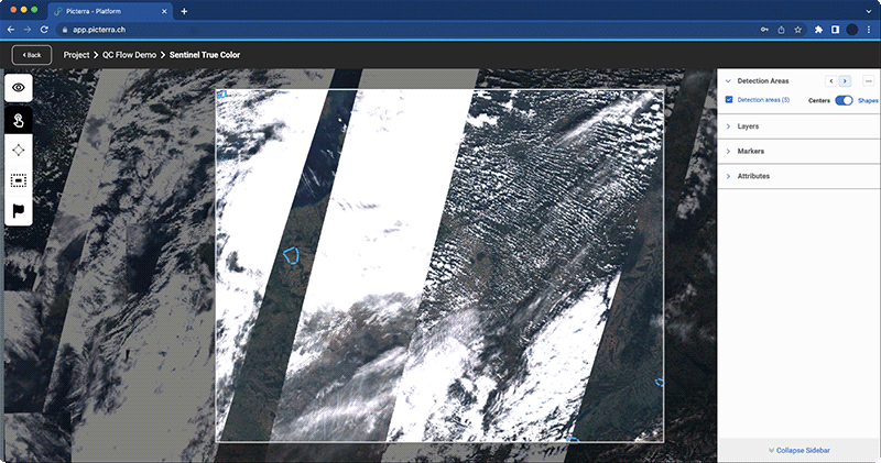
Visual navigation & editing: Seamlessly navigate through existing detection areas, simplifying the inspection of results at scale and making direct edits as needed.
Creation from vector layers: Introducing the ability to create new detection areas directly from vector layers unlocking advanced workflows like chaining detectors together. For example, imagine first training a model to detect train stations. Once detected these can be themselves turned into detection areas for the purpose of detecting and counting cars parked in proximity to each train station.
Dedicated panel & toolbar: A user-friendly panel accompanied by a toolbar simplifies the drawing and editing process of new detection areas.
2. Enhanced band settings display
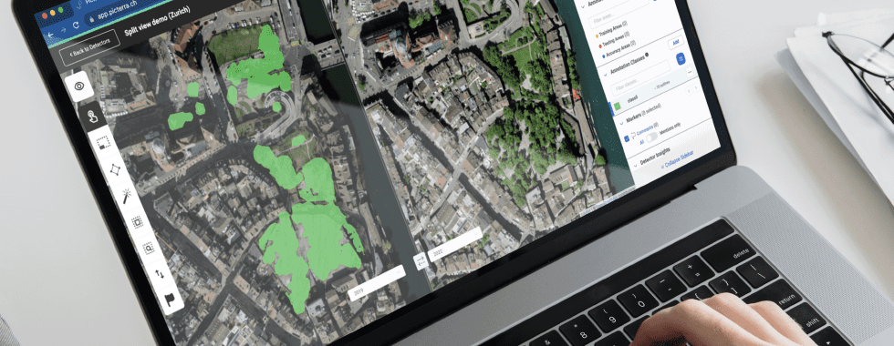
Easy navigation: Effortlessly visualize different band setups within an image. This is particularly beneficial for inspecting images formatted for change detection – visualizing two dates side by side – or for multispectral images that contain more than 3 spectral bands (e.g., RGB and DSM or RGB + NDVI and so on).
Quick band spec switching & split view: Toggle between bands more efficiently, and compare two band settings side-by-side, such as an RGB and DSM image combining optical and height information images tailored for change detection.T
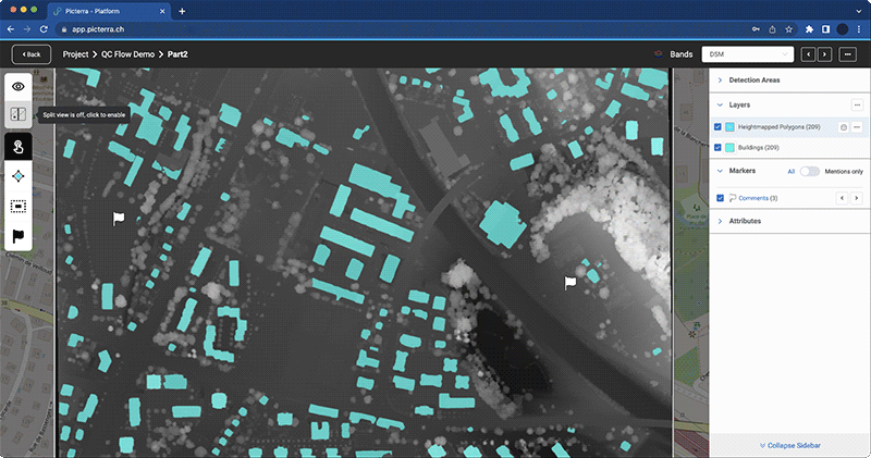
3. Vector layers attributes enhancement
Expand the depth of information regarding detections by directly editing attributes in Picterra, allowing you to attach metadata to detections in a seamless manner.
Creation & editing capabilities: Boost your analysis by creating and editing attributes for detections within vector layers. Enriched data means more profound insights.
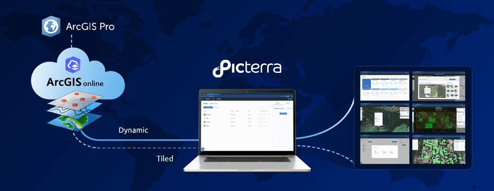
Visualizing advanced GIS tool outputs: Now, the results from Picterra’s advanced GIS tools (such as “DSM height extraction”) can be visualized directly within the Picterra platform, bringing more comprehensive and detailed insights to the forefront.
4. Intuitive detection results viewing & editing
Mouse-based mass selection: Supports mass delete functions and facilitates detection editing.
Enhanced detection results viewing: Make viewing and editing detection results straightforward and efficient.
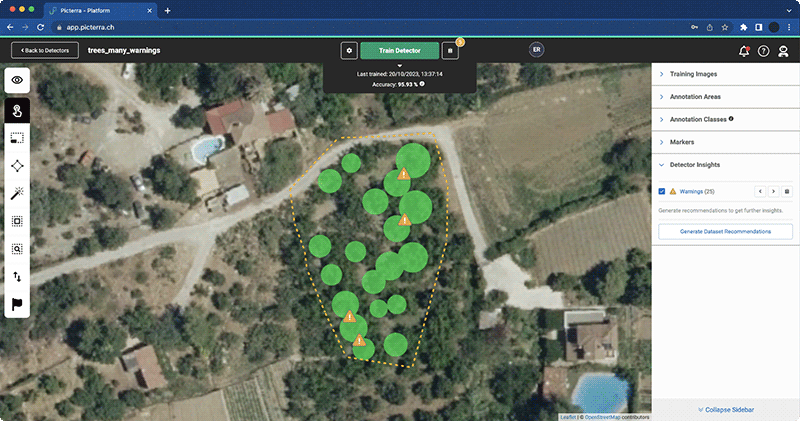
5. Localizing insights for enhanced detector training
Building a detector can be a challenging endeavor. At Picterra, we’ve been continually refining our platform to support you every step of the way. Our history of enhancements tells this story with the introduction of our pioneering dataset recommendation and advanced debugging features within the training report (embraced by up to a whopping 80% of our users during detector trainings).
Based on your feedback and our commitment to continual improvement, we are excited to announce the extension of the localized nature of dataset recommendations. The spotlight of this update is the introduction of localized warnings.
Localized warnings are designed to offer you precise feedback on potential issues or mistakes in your dataset. Rather than sifting through tons of data to locate a small discrepancy, these warnings will directly point you to the problematic areas. This means:
Decreased debugging workload: The tedious task of debugging is made easier, allowing users to quickly refine their datasets.
Spot potential issues effortlessly: Especially in larger datasets, localized warnings shine a spotlight on areas needing attention, simplifying the troubleshooting process.
Key benefits of these improvements
Accelerated quality control: Streamline the quality control process for detector outputs, refine detections using additional layers, and use results as detection areas for cascading detectors. This means faster, more accurate results, shaving off crucial time from your analysis workflow.
Attributes viewing for vector outputs: Now, users can view attributes directly within the raster view for vector outputs, paving the way for a more comprehensive understanding of the detected features and fostering detailed analysis.
Efficient detection areas management: Navigate and manage detection areas with increased efficiency.
Spot potential issues or mistakes in your dataset: Whether you’re a seasoned expert or just starting, localized warnings will drastically reduce the time and effort required to refine your dataset and pinpoint potential issues.
Get started
At Picterra, we believe in empowering our users. These updates are a reflection of our efforts to simplify the detector-building process. Our focus is on improving the accuracy and efficiency of your geoAI analysis. Explore the Picterra platform today to familiarize yourself with these updates. Don’t have access to the platform yet? Get in touch to discuss your use case!