


Supercharge your Picterra platform experience with our range of professional services. Get support from our experts to handle the heavy lifting whilst empowering you to maintain complete control and leverage all platform features. From imagery sourcing and model training for specific areas of interest to automating change detection and analysis workflows or addressing your unique reporting requirements, we are committed to ensuring your success.
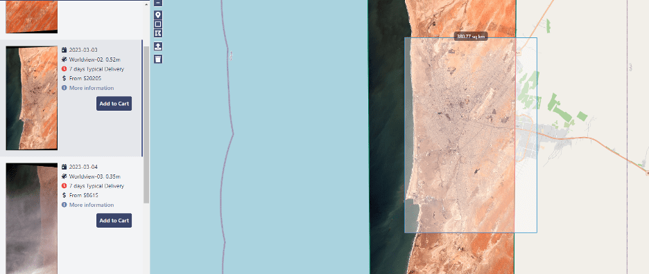
Benefit from end-to-end support in image procurement, thanks to our established relationships with satellite and drone imagery providers and distributors. We seamlessly facilitate the data assessment and procurement process, ensuring that the imagery obtained perfectly aligns with the requirements of your specific use cases.
Additionally, our team’s deep expertise in image pre-processing guarantees top-notch quality in geo-referencing and radiometric calibration of delivered images. This ensures that the images are ready for optimal use on the platform, saving you time and effort.
Our team offers rapid prototyping to jumpstart your library of custom detectors. This can be followed by comprehensive training and improvements to ensure they are ready for production. Furthermore, our team is equipped to upgrade your existing models when faced with new geographies, seasonalities, or other situations that require further adaptation.
Count on us to empower your machine learning models on the Picterra platform, ensuring they deliver optimal performance for your specific needs.
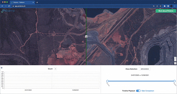
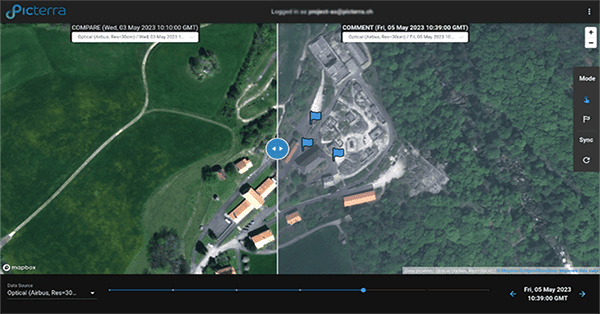
The Picterra platform stands as your ultimate support, equipped with an array of integrated tools to accelerate the creation of specialized change detection models. By streamlining annotations, we facilitate efficient training of algorithms, while our platform ensures precise image preparation and data raster configuration, attuned to track changes based on your defined parameters and sought-after differences.
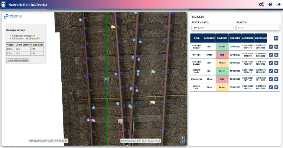
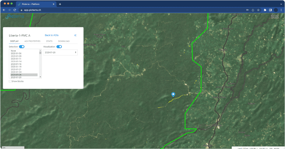
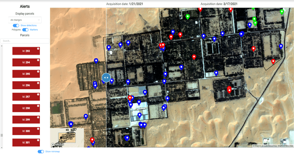
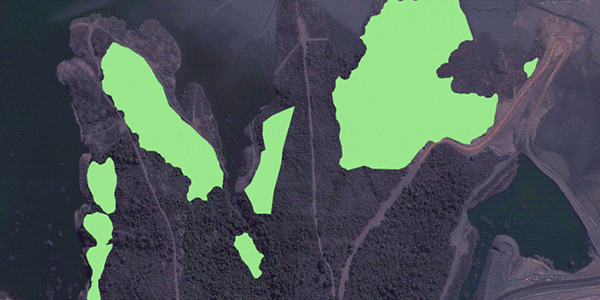
Monitor and track changes in land patterns and objects, identifying unusual behaviors that require alerts. This includes precise scenarios, such as subtle rotations of screws on railway tracks or the expansion of cracks in mines. Additionally, observe detailed transformations over large areas, like specific deforestation patterns, roof damages, or flood-affected regions.
Navigating change detection has never been easier. Our expert team aids in selecting your ideal detection method, tailored to your unique use case. Together, we shape your workflow, complete with a custom results dashboard and seamless integrations.
Enhance the integration of your detector results into other applications or enjoy interactive dashboard visualizations. Our team is here to support you in tailoring the format of your results to meet specific output requirements.
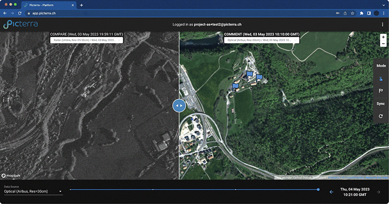
Leveraging Picterra’s advanced platform tools and on-cloud script capabilities, we can also create pre- and post-processing GIS workflows and customized web dashboards that empower users to seamlessly navigate and interact with both imagery and output GIS data. Experience a smooth integration of your results into other applications, while benefiting from a user-friendly interface that allows for easy exploration and analysis.
Furthermore, we specialize in developing integrations with third-party software and platforms, ensuring a smooth transfer of your Picterra experience with your day-to-day operations.
Leverage Picterra’s geospatial AI for proactive EUDR risk assessment
Benefit from our partnerships with the top satellite image providers.
Explore our network of data capture and GIS analysis experts.
Check out our growing number of Picterra integrations.