Written in cooperation with BC Hydro
Authors: Mark Sherrington, Murray Chapple
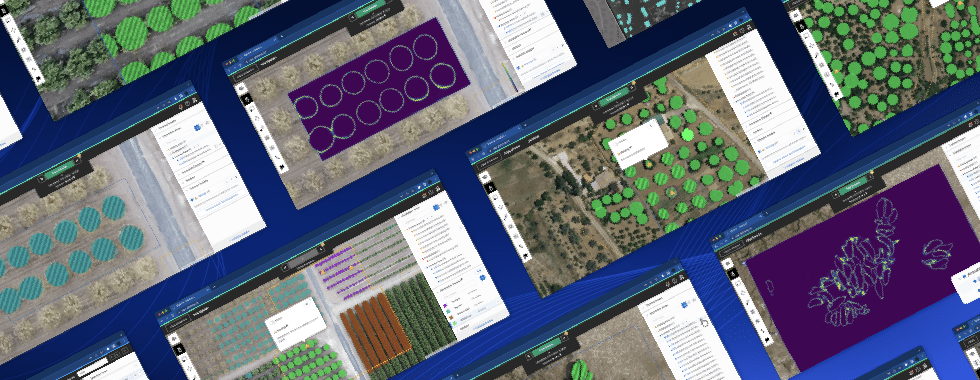
BC Hydro is a Crown Corporation in the Canadian province of British Columbia. Their mandate is to safely provide customers with reliable, affordable and clean electricity throughout the province. This case study shows how BC Hydro used Picterra as part of their debris management program on Kinbasket Reservoir to map 230 kilometres of shoreline to determine the location and volume of the debris.
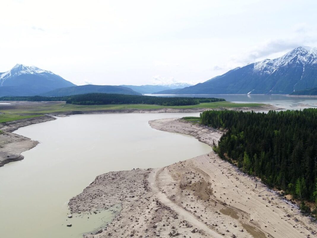
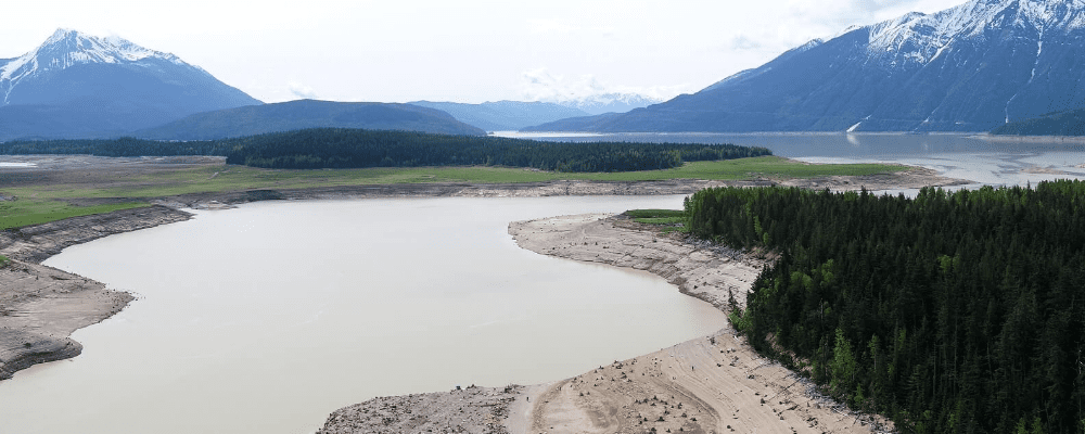
Kinbasket Reservoir. This photo was taken by Murray Chapple, who has flown his drone over the reservoir and analyzed the debris inventory using Picterra.
Water use planning is an example of sustainable work in practice at BC Hydro, a Crown Corporation in the Canadian province of British Columbia. The overall goal of this program is to find a better balance between competing uses of water, such as domestic water supply, fish and wildlife, recreation, heritage, flood control and electrical power needs, which are environmentally, socially and economically acceptable to British Columbians. Water use plans (WUPs) were developed for most of BC Hydro’s hydroelectric facilities through a consultative planning process involving participants, such as government agencies, First Nations, local citizens and other interest groups.
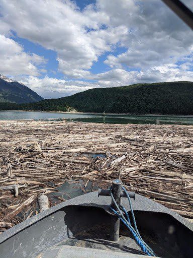
This photo (taken by Murray Chapple) clearly shows the importance of the debris removal program
with floating wood collected using a long floating log boom towed behind a tugboat.
The WUPs strive to balance the effects of how the reservoirs are operated for flood control and electrical power needs with wildlife habitat, archeology resources, and recreation uses such as boating and fishing.
The Kinbasket Reservoir was formed by impounding the Columbia River behind the 244 metre tall Mica Dam in 1973. The reservoir area (425 square kilometers) was partly cleared of the coniferous forest below the high water mark (full pool of 754.4 metres above sea level). The method of log recovery was to float the logs as the reservoir filled and then gather and use as many of those logs as possible for commercial purposes. However, some of the forest was not fully logged and not all logs were salvaged. These remaining trees contribute to the current woody debris within the reservoir that is now managed under the Kinbasket Debris Management Program, which is part of the Columbia River Water Use Plan. Additional wood enters the reservoir through the numerous high energy mountain streams, landslides, and snow avalanches.
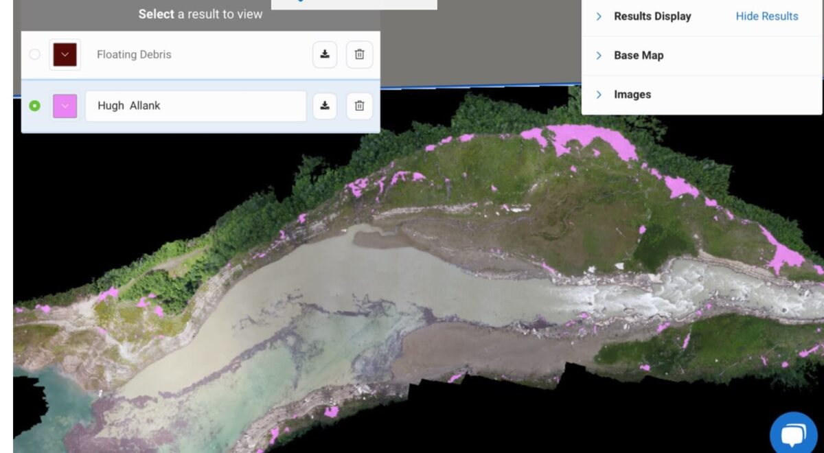
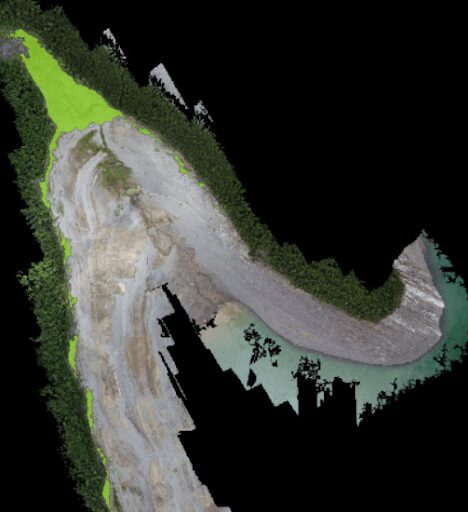
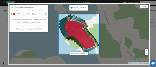
A screenshot of the Picterra platform, delineating areas of detected landed woody debris as pink polygons.
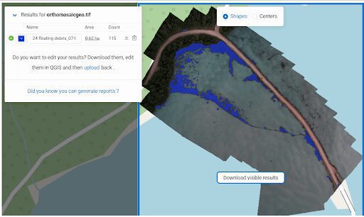
A screenshot of the Picterra platform, delineating areas of detected floating woody debris as brown polygons.
The programs in place date from 2007 when the Columbia River Water Use Plan was developed by a multi-stakeholder consultation process. The plan is regulated by the provincial Comptroller of Water Rights under the provisions of B.C.’s Water Sustainability Act (the Act). Under the Act, Terms of Reference (ToR) were written for studies and physical works such as the debris removal program. For the Kinbasket Debris Management Program, the main objectives at the onset of the program were to conduct a current debris inventory as a tool to evaluate the success of the debris management and removal at five-year intervals. The key reason for the debris inventory was for the Kinbasket Reservoir to be as free as possible of woody debris to improve safety and recreation on the reservoir. The debris management program has also enhanced the growth of natural and planted vegetation in the uppermost parts of the reservoir with targeted removal of wood debris from environmentally sensitive areas such as marshes.
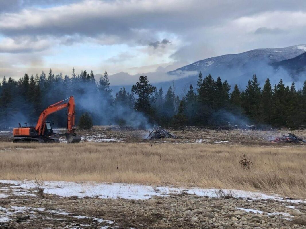
A photo taken by Natalie Dechka of Spaz Logging, showing removal and burning of wood debris from a marshland area in winter to enhance vegetation growth and improve shoreline access.
Unmanned Aerial Vehicle (UAV) Program as part of the Debris Management Program
UAV is a very effective tool to help plan and allocate efforts in debris management and to remove debris each year. For example, the UAV Program can help to focus efforts to best meet the program recreational and environmental objectives. UAV can be used to determine the amount of debris removed each year and roughly estimate the volumes from erosion, tributaries, and log transport that are added. Due to the large size of the reservoir, it is not possible to get an inventory of all debris inputs to the reservoir each year using a UAV. At the end of each year, BC Hydro provides their regulator with an update of the wood debris volumes removed in that season and a table of the amounts remaining. The UAV aerial perspective provides a visual yearly photo log from an aerial perspective (before and after debris removal) which complements field photos taken on the ground level. This provides a visual record of the progress being made.
A screenshot of the Picterra platform delineating areas of detected landed woody debris as green polygons.
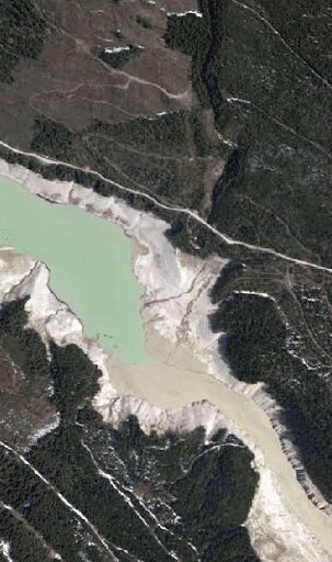
Aerial Photography flown in May 2019.
The UAV-based debris inventory is complementary to a traditional aerial photography-based inventory that was undertaken in May 2019. The aerial photography is used to get a “snapshot” of all the woody debris remaining in the reservoir at the time of photo capture from an aircraft. The aerial photography method does not provide an inventory of the ongoing inputs of debris into the reservoir from rivers, landslides and avalanches like a UAV can. Aerial photos are used in a detailed inventory for a particular time “snapshot” of one flight every five years.
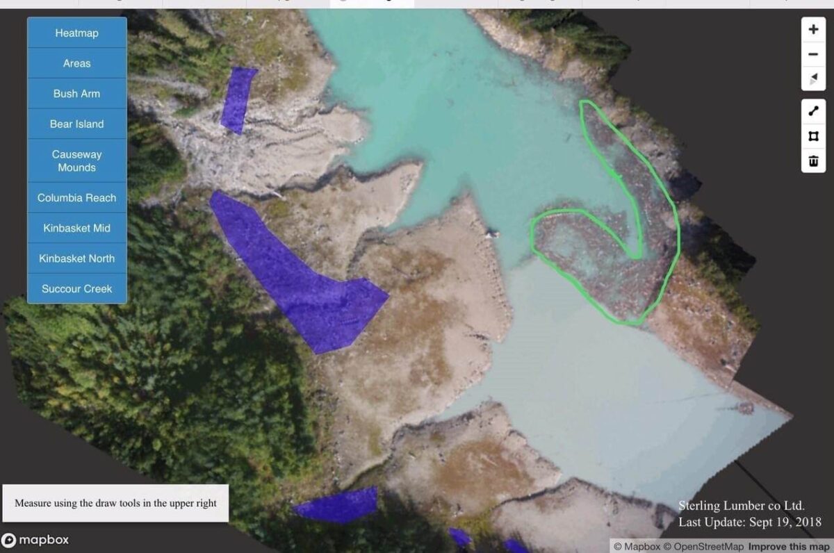
A 2D map with manual polygons around debris prepared by Blacklin Consulting, a company that offers photogrammetric image processing for the unmanned aerial systems industry.
In contrast, the UAV can be deployed quickly to check on debris inputs and movement in new landslides or high river flows and to get an aerial view of the debris-covered area before removal. The UAV is flown overhead during debris removal showing piling and burning of debris and then after the work is done will debris removed. The video, digital modelling and photography (2.5 to 3 cm per pixel) collected by the UAV helps us to measure the debris volumes collected in the program quickly. The Picterra software used for this analysis is successful in distinguishing debris from tree stumps (which are not usually removed) and to quickly delineate the debris area and density, a task that is very time consuming and costly using traditional aerial photography interpretation techniques. The detector on the UAV is “trained” to look for a light signature (color) and is at least 90% accurate in separating wood debris mats from other materials such as gravel and vegetation when generating polygons of the debris areas as seen in the figures. The outputs are used to update the public and regulators on our progress.
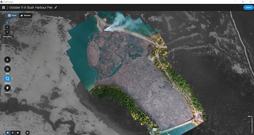
Orthomosaic created in Pix4d of a 8.9 ha area of wood debris collected from the reservoir in 2020.
Orthomosaic analyzed using Picterra software measure area of wood debris used in volume of wood calculations.
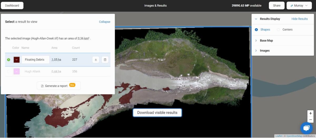
A screenshot of the Picterra platform presenting the result of detecting debris.