Cities and urban areas worldwide are growing and evolving, which progressively interfere with wild, previously uninhabited areas. Unfortunately, it leads to a higher risk of fire, especially in the areas that are near the woods or consist of many lightweight, wood-frame constructions. In light of the above, it’s not surprising that city councils, fire and rescue offices, vegetation management offices, and individual property owners are deeply interested in fire risk assessment.
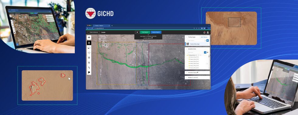
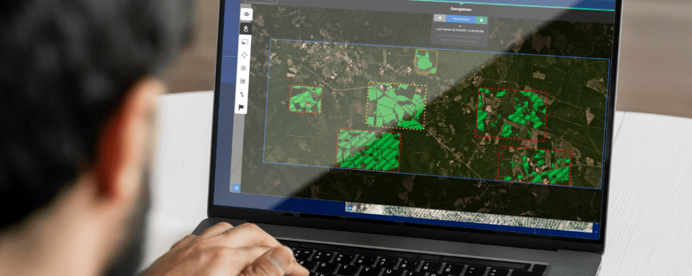
Detection Results Overview & Side by Side image comparison to validate results.
Geographic information systems (GIS) are a tremendous help in tackling the issue. They allow communities to identify potential risk factors and community hazards, thanks to which fire offices have more data to provide fire protection to the community. However, two crucial factors contribute to the success of the assessment.
- Availability of data. Unfortunately, up-to-date and high-quality geospatial data is not always easily available in every location in the world. That’s why drone monitoring services are crucial in data collection, and drone operators are equipped with high-resolution cameras.
- The number of resources that must be spent on analyzing the data. Investigating imagery, counting objects, and looking for patterns manually is extremely time-consuming, tedious, and prone to errors. Analyzing large locations in such a way is often impossible in a reasonable time. Machine learning-based models solve this issue, and Picterra is a perfect solution for that purpose.
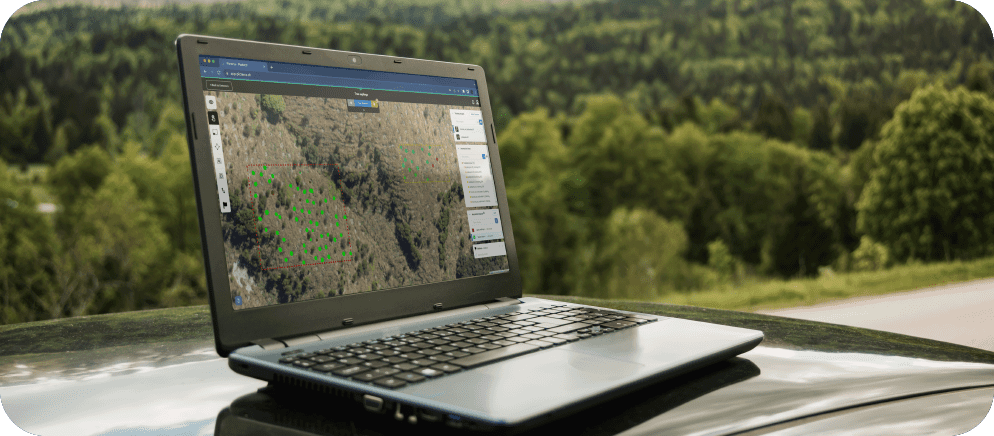
Here is a look at how the whole process works – from data collection to the final results:
Detecting buildings
Analyzing different types of buildings is usually a priority in fire risk assessment, especially in geographic conversion zones that border urban developments. In theory, it could be based on real property records, but not every region will have this information available digitally. Besides, informal settlements are also not uncommon. In light of these facts, it’s crucial to get up-to-date data and to take action based on the real situation. Picterra is an excellent example of the platform that allows for building the above mentioned AI workflows on satellite, aerial, and drone imagery. Because the platform is highly flexible and is not limited to specific use cases, Picterra’s algorithms can be trained to accurately detect very different types of buildings – American style, European style, slums, both industrial and residential buildings, refugee camps, and so on.
With Picterra, it’s fast, efficient and doesn’t require coding or machine learning skills. In short, all you need to do to detect buildings is to:
- Upload imagery. We facilitate accessing satellite imagery through our portal. However, for fire risk management, you probably need to bring your own up-to-date and local data.
- Train your machine learning model. We’ve covered it in detail in this step-by-step guide on how to build a custom detector, and we recommend reading it before moving on.
- Picterra is remarkably fast, but you can get even faster by using our pre-built detector, which is ready to detect buildings.
- Your results are ready. You can share them or download them to integrate with other GIS software you may use.
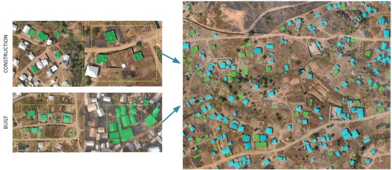
Example of buildings detector built on satellite imagery from Cameroon.
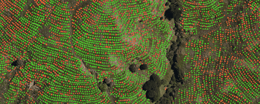
Detecting vegetation
In fire risk assessment, it can also be essential to analyze the surrounding vegetation. On Picterra, you can do it precisely the way we presented when detecting buildings. You need to import imagery, choose your training areas, add a few annotations, and build a detector. You may need multiple detectors for different vegetation classifications, but the same process will apply to detector creation. Or take a shortcut using one of our pre-trained, base detectors to test your imagery based on predetermined detection criteria.
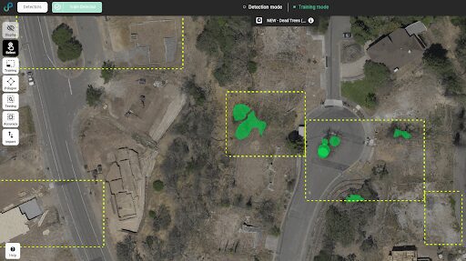
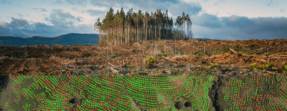
Example of the detector built to identify dead tree canopies. Inclusion objects shown highlighted with green polygons, exclusion areas left empty.
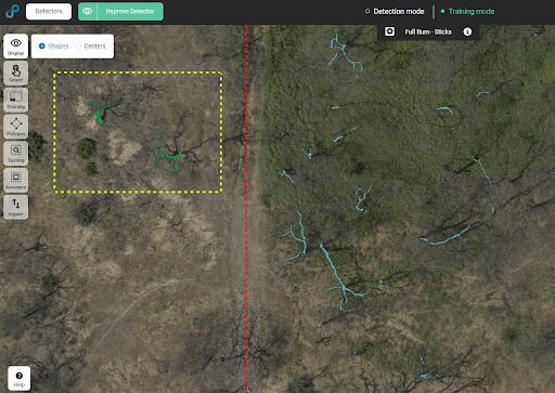
Example of Custom Detector built to identify fully burnt trees while avoiding shadows. Inclusion objects highlighted with green polygon, test detection objects highlighted in light blue.
Fire risk assessment – summary
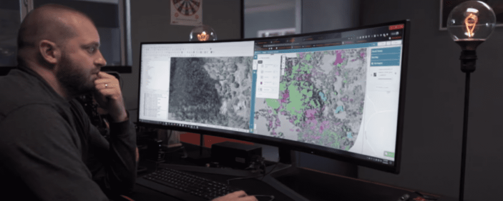
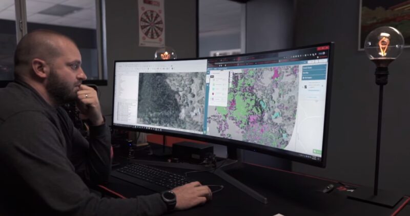
The final piece of the puzzle is merging all of the detector data together with outside data sources to assess the potential risk areas. C2 Group uses the ESRI Shape File outputs of the detector data for use in ArcGIS. They are then combining the detector data with additional modeling features for slope analysis, weather modeling, historic images, and change detection overlays to create a full risk profile of the surveyed area. When it comes to safety, there is no room for error. Fire risk assessment requires both up-to-date data and state-of-the-art technology. Never before have both been as accessible as now – drone monitoring services are widely available; and with Picterra, everyone can build a highly accurate custom machine learning-based AI model.
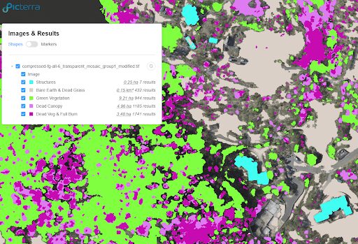
Results Report – All custom detectors built for this project.
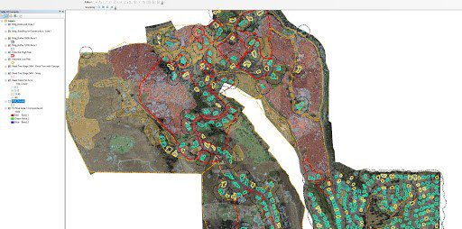
Picterra shapefile output merged with property data, slope analysis & encroachment buffers using ESRI ArcGIS.
For additional information about this specific project and the application of drone data acquisition and machine learning, please take a few minutes to watch this video: