The best way to predict the future is to create it
Various forms of this quote have been attributed to many people, from the US president Abraham Lincoln to famous management guru Peter Drucker, and in the form above pioneering computer scientist Alan Kay.
At Picterra we envisage a world in which every company will be a geospatial-driven business. We have been hard at work ensuring that we create this future by continually evolving and innovating our platform, with this year being no exception. With that, we present to your our roundup of the biggest launches of 2022.
In last year’s recap, we outlined how we were building the foundation for enabling live collaboration on a detector in the same way you would work seamlessly together on a Google doc. This year we introduced several new features to make that vision a reality.
Following a series of platform upgrades that made it easy for large teams to administer their account and permission sets, we then added the ability for multiple users to enter a detector concurrently and provide input through markers and comments.
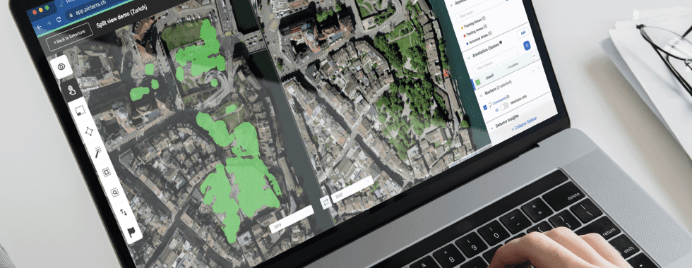
Identified by an avatar in the top bar of the interface, users can see who is accessing the detector and which area of the image they are working on. By placing markers on the image, users can create comment threads within which they can tag other users.
However, we didn’t stop there and just a few months later we launched additional collaboration features allowing multiple users to enter the detector and cooperate on the model in real time.
Now team members can simultaneously share annotation tasks, instantly exchange ideas, raise questions, or check in for improvements all from within a new live chat interface. The status of assigned tasks can be managed by directly tagging specific users who need to take action with resolutions handled with the help of markers.
One of Picterra’s main focuses is to provide not only easily accessible but also easily understandable machine learning tools to our users. With that in mind, we added another set of machine learning settings to the custom detector builder to give users more freedom with their experiments on Picterra.
Now our users have the ability to change the backbone model, tile size, and background sampling ratio in order to potentially improve the performance of their models.
Towards the end of this year we announced powerful new data curation and exploration technology that allows users to get a better understanding of their datasets and improve model accuracy.
The Data Exploration Report is an industry-first innovation that helps users reveal visual patterns in their data and provide key insights for better and more robust detectors.
Accessible alongside the training report, the Data Exploration Report allows a quick assessment of the training coverage and identifies areas where the user should concentrate on future iterations.
Dataset exploration can also be used for “data curation” approaches and in conjunction with the collaboration features detailed earlier. This is when you have a team of annotators and you need to assign them to images to annotate. By selecting the region to annotate using the Dataset Exploration Report, you make sure that you distribute the annotation workforce as efficiently as possible because they will annotate regions that maximize the diversity of appearance covered by the dataset.
Just last week we introduced the first set of Advanced Tools, designed to help streamline and simplify workflows by providing access to powerful analysis and processing tools directly within the Picterra platform.
The first three tools included are NDVI analysis, DSM height extraction, and image stacking with our aim to build in many more over the coming weeks and months.
Our product strategy is laser-focused on delivering even more value to enterprise-scale teams and we listen closely to our users in order to achieve this. We’re very encouraged by their feedback and excited about the future roadmap for the Picterra platform.
Join us on January 18th for a special webinar where we will showcase Advanced Tools and discuss the future of the platform as we work to broaden the feature set making it even more useful for more users.