


Industry:
Forestry
Business type:
Geospatial technology and the future of forestry management
Larger organizations and governments are increasingly making big investments in geospatial data and technology. But how do they ensure they are getting value from these expenditures by infusing recent innovative advancements, such as high-resolution daily satellite feeds and machine learning?
We recently sat down with Skytec, one of our clients, to learn more about how they are enriching their geospatial services with machine learning. Focused on geospatial technology and the future of forestry management, the discussion was also an opportunity for Andy Carroll, CTO & Co-Founder of Skytec, to delve into how Picterra answers this question.
Challenged with rising demand for geospatial analysis and a need to transform its offering with more innovative approaches Skytec had to decide between building the tech themselves or looking outside the business. For Andy the answer was clear:
In the beginning we looked at building our own cloud deployment and spinning up deep learning algorithms by focusing heavily on the IT side of things and hosting it all ourselves. If you try to do it in-house it’s going to be extremely expensive, intense for staffing, and can be a real pitfall that can prevent you from even getting started. However, when you can outsource that with a trusted partner like Picterra you can push a lot of that development cost.
Andy Carroll, CTO & Co-Founder, Skytec
Based in Chattanooga, a city in southeastern Tennessee, Skytec has been serving clients throughout North America since 2015. As a leader in Unmanned Aerial Systems (UAS), remote sensing, and Geographic Information Systems (GIS) technologies, they have been closely following rapid developments in the industry over the past few years.
They identified early on that as their own clients’ need for geospatial intelligence grew, the only way to deliver monitoring at scale was to use machine learning:
What we’re focused on at Skytec is the whole macro scale monitoring and verification with the unmanned systems. We’re passionate about these two technologies coming together to solve problems, to better manage natural resources, and help as we adapt and try to evolve with the effects of climate change.
Andy Carroll, CTO & Co-Founder, Skytec
Following a period of rigorous testing Skytec chose Picterra as their technology partner thanks to a number of factors including the platform’s ease of use, strong collaboration with the engineering team, and the ability to integrate with their existing workflows, tools, and deployment:
We started out a year and a half ago, and it is very straightforward. You can bring in your annotations as KMLs or JSON files or you can draw them and detect and manage all of your projects within the built in CMS in the platform. It works the other way as well, I can easily take these products and export them in a format that goes back into our ESRI enterprise GIS. It’s basically coupled the Picterra engine to our larger enterprise deployment – it could be an automated two way street or a person manually testing and training – they’re very scalable.
Andy Carroll, CTO & Co-Founder, Skytec
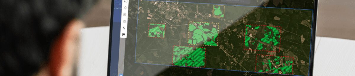
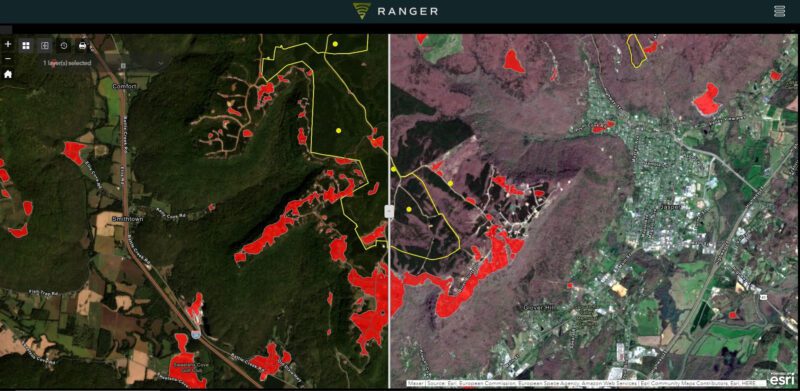
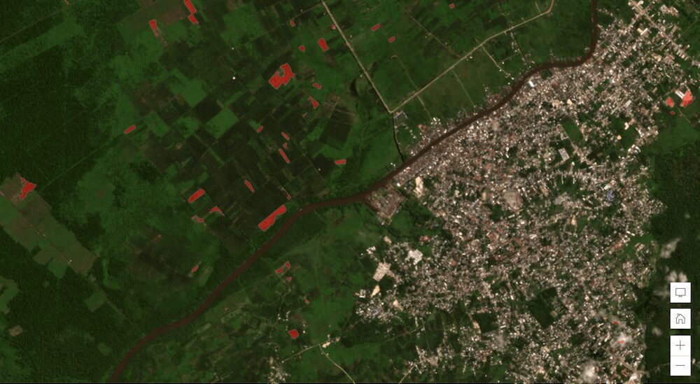
Ranger is Skytec’s cutting-edge remote monitoring application which leverages Picterra’s machine learning algorithms to detect change in a client’s area of interest (AOI), extract features, classify land use or assets, and report results.
Picterra is a critical piece of the Ranger product. It’s allowing us to automate and giving us future opportunities to scale in service areas as we monitor larger areas and portfolios of AOI for clients.
Andy Carroll, CTO & Co-Founder, Skytec
For one of their customers in the southeastern US, Ranger was able to quantify over 44,000 polygons in a matter of hours and in just one day of training achieve a detection accuracy level of 86%. For the use case in question this was deemed accurate enough so that the model could be used over a three state region in the southeastern US and detect change at scale over several million acres.
In the natural resource and environmental markets, Skytec typically works with three categories of customers:
By partnering with Picterra and integrating advanced machine learning into their products, Skytec have been able to scale and grow their solutions, expanding their scope of operations and services. Their customers are already benefiting from this partnership, freeing up their time for more value-added work:
Enormous time savings for being able to pinpoint areas where we either have an activity that was detected, we can get a specific geography, you can hand that off to a forester or to a land steward or even just compile the metrics and put that into a dashboard for the business management group to have situational awareness within their area.
Andy Carroll, CTO & Co-Founder, Skytec
For Skytec, Picterra is an important piece of their ecosystem of solutions and embedded within their key products. They now have a whole team of data analysts and technicians ready to develop new detectors for different client needs.
It’s really been an exciting development over the last five years of the explosion of new remote technologies, machine learning technology like Picterra, and the focus on ESG. Everything’s coming together and technology is a big assistant
Andy Carroll, CTO & Co-Founder, Skytec
