Thanks to Patrick Kinsella at Elevated Solutions for his subject matter expertise that informed this article.
Unless it is your job to construct, maintain, inspect, or repair it, it’s easy to overlook the importance of paving. Roads, parking lots, driveways, sidewalks – pavement is just everywhere we look.
But what if we told you that there are about 65 million miles of pavement around the world that needs to be regularly inspected as part of its maintenance? The American Society of Civil Engineers estimates that 32% of the U.S.’s public roadways are in substandard condition, translating into an annual economic cost of more than $100 billion.
If you care for paving properly, the lifespan is about 30 years. If you don’t, well, it plummets to about 5 years before you need to replace it. Not only is that very expensive. The asset owner also risks being held liable for damages or personal injury that occur due to negligent maintenance. That’s why it is crucial to have a pavement conservation plan that outlines the current health and maintenance schedule.
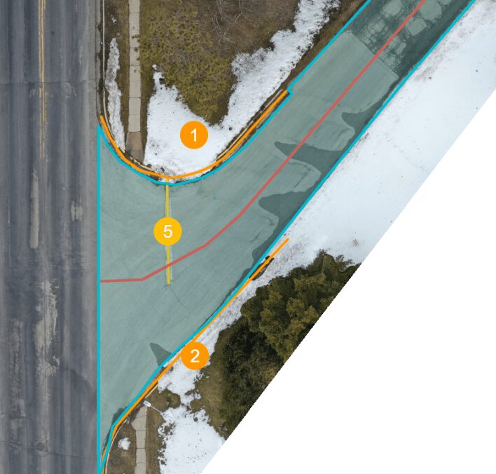
Assessing a 10-acre commercial parking lot typically requires 3-5 man-hours. The parcel would need to be completely cleared of vehicles, causing major disruption to the property owner’s operation and customer experience. (Think about it: the parking lot is usually the first impression a retailer makes!) The estimator then needs to inspect every crevice and document every defect with annotations that correlate with all of the industry standardized assessments.
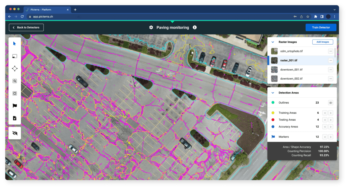
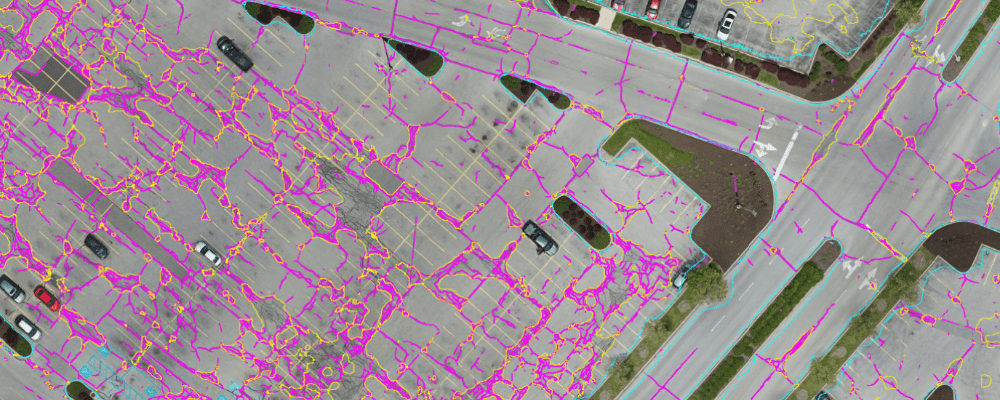
AI detecting pavement cracks & erosion
If the same estimator would instead use a drone to take high-resolution pictures of the parcel, the parking lot would only need to be empty for roughly 20 minutes. Feeding the pictures into Picterra and training the deep learning models to classify the defects would take another 20 minutes. All in all, the estimator would shave off hours of work, with much more consistent output! Here at Picterra, we believe in automating as much of the grunt work as possible so professionals can free up time to spend on more value-added tasks.
Additional benefits include:
- Increased accuracy – Have you heard the adage “send three people to measure something and you’re going to receive three different measurements”? That is one of the main reasons why the paving industry ought to use machine learning models. By being able to assess properties across the globe in an objective, standardized way, the whole industry can benefit from collective insights on where to prioritize repairs to prevent costly deterioration.
- Improved working conditions – Imagine a world in which inspectors don’t need to travel thousands of miles per year to do their jobs. Estimators can perform their duties from behind a desk by letting a local drone service provider obtain the pictures. It has several positive benefits:
- Time and cost savings for each assessment
- Reduced health risks associated with fieldwork surrounded by careless drivers and hazardous fumes
- Cheaper insurance premiums by reducing the risk of vehicular accidents
- Reduced environmental impact – Reconstructing a large road can take months, even years, to complete. It requires large paving crews and heavy equipment. By having a pavement conservation plan with regular inspections, you can avoid having to re-pave the area every ten years and reduce the adverse effects on the surrounding environment.