In the heart of industries that power the modern world lies the essentiality of mining operations. The metals that make our smartphones, power our electric vehicles, and keep our technology-driven world turning all come from mines. But as the demand for these metals increases, so does the scale of mining operations. And with these large-scale operations come significant safety concerns.
Mines are rugged and potentially dangerous places, not only for the workers but also for the environment. Safe mining isn’t just about keeping operations running smoothly; it’s also about minimizing the impact on the surrounding terrain, public perception, and social responsibility.
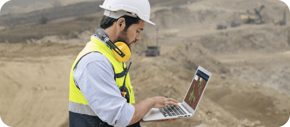
That’s where GeoAI, the combination of geospatial analysis and artificial intelligence, proves valuable. With its potential to transform mining safety, particularly in the area of terrain stability analysis, GeoAI is already making a significant impact.
In this article, we’ll explore how GeoAI changes the face of mining safety. We’ll look at how it can detect hazards early, monitor terrains in near real-time, and offer new preventative safety measures in the mining sector.
Understanding mining terrain stability
Mining operations exist within a dynamic interplay of geology, topography, and human intervention, navigating terrains that are inherently susceptible to instability. That said, the talk of mining safety can’t start without understanding and managing terrain stability. This complex area poses significant challenges for traditional risk assessment and monitoring methods.
Unstable terrain can lead to disasters such as landslides, putting lives at risk and stopping operations in their tracks. Unpredictable geological formations, fault lines, and natural erosion exacerbate the complexities associated with terrain stability. Moreover, the dynamic nature of mining activities—excavation, blasting, and material extraction—further alters the landscape, creating potential instability hotspots.
Traditional methods of terrain stability analysis rely heavily on manual data collection and interpretation, which can be time-consuming, costly, and error-prone. They also lack the ability to detect subtle changes in terrain over time, leaving mines vulnerable to unexpected hazards.
This is where GeoAI comes in. By leveraging advanced technologies such as remote sensing, machine learning, and data analytics, GeoAI offers a more comprehensive and efficient solution for terrain stability analysis.
Historical incidents highlighting the need for terrain stability analysis
Several unfortunate incidents throughout history have emphasized the impact of unstable terrains on mining safety. For instance, in 2010, the world witnessed the Copiapó mining accident in Chile, where 33 miners were trapped underground for 69 days due to a significant landslide. The mine had a history of instability incidents, and this catastrophic event underscored the critical need for sophisticated terrain stability analysis.
Another poignant example is the Aberfan disaster in Wales in 1966. A colliery spoil tip on a mountainside above the village of Aberfan became unstable after heavy rain, leading to a landslide that engulfed the village and a local school. Tragically, 144 people lost their lives, including 116 children. This disaster highlighted the direct risk to miners and the potential broader community impact of unstable terrains in mining areas.
Such incidents underscore the need for robust, reliable, and real-time terrain stability monitoring systems to enhance safety in the mining sector. Advances in GeoAI provide promising solutions for these issues, potentially preventing such disasters in the future. Let’s explore this further.
GeoAI and terrain analysis in mining safety
Now that we have established the critical need for terrain stability analysis in mining safety let’s understand how GeoAI can enhance this process. GeoAI, also known as geospatial artificial intelligence, is the application of AI techniques to geospatial data for analysis and decision-making. This technology has already revolutionized various industries, including agriculture, transportation, and urban planning. In the mining sector specifically, GeoAI has been used for tasks such as mineral exploration, resource estimation, and environmental impact assessment.
However, one area we will focus on, where GeoAI’s impact has been particularly significant, is terrain stability analysis. By integrating geospatial data from various sources and applying machine learning algorithms, GeoAI can provide accurate and real-time insights into terrain stability. This allows mining companies to proactively identify potential hazards and take necessary precautions to avoid them.
Let’s dive deeper into how GeoAI can enhance mining safety through terrain analysis.
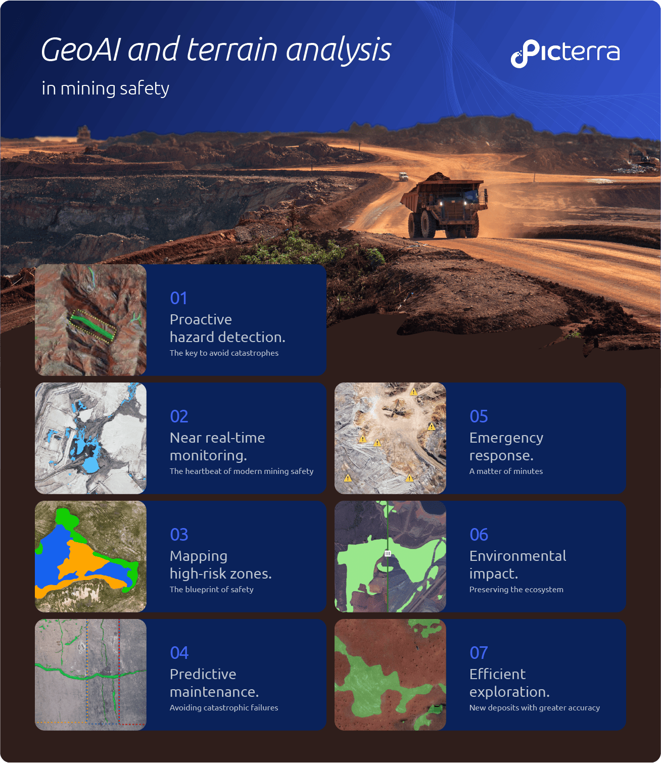
Proactive hazard detection: The key to avoid catastrophes
As previously mentioned, terrain hazards in mining areas can manifest in various forms, including landslides, rockfalls, and soil erosion. These hazards are not always apparent and can occur suddenly, posing a significant risk to miners’ safety and the surrounding communities.
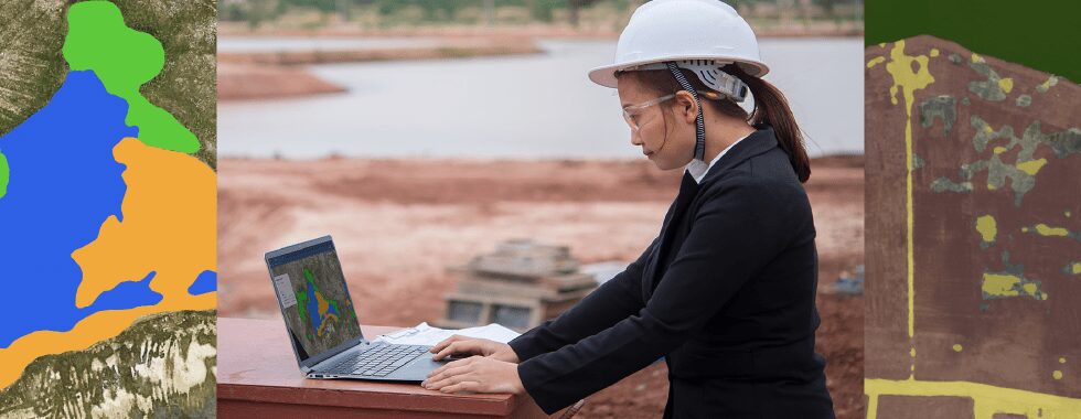
Perhaps one of the most significant contributions of GeoAI to the domain of mining safety is its ability to spot potential hazards well before they pose a threat. Through the integration of satellite imagery, LiDAR data, and geological maps, GeoAI can create highly accurate 3D models of terrain conditions.
With its capacity to analyze terrain data with extraordinary accuracy and speed, GeoAI facilitates the early detection of potential hazards. It predicts events like landslides, subsidence, and other terrain instabilities before they fully develop. This foresight allows for timely preventive actions and the implementation of risk mitigation strategies, thereby elevating the safety standard within mining operations.
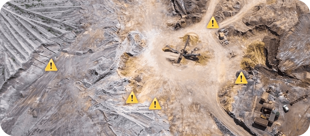
Near real-time monitoring and analysis: The heartbeat of modern mining safety
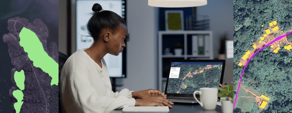
The prowess of GeoAI isn’t confined to just hazard prediction; it also encompasses real-time monitoring and analysis of terrain conditions within mining sites. GeoAI’s continuous data collection and interpretation capabilities offer invaluable insights into the changing dynamics of terrains. This constant stream of information enables mining operators to swiftly adapt safety measures to the changing conditions, thereby ensuring the safety of workers and maintaining operational continuity.
By using sensors and Internet of Things (IoT) devices, GeoAI can collect and analyze data on a wide range of factors that influence terrain stability. These include precipitation levels, temperature fluctuations, ground movement, and other geological variables.
This data is then fed into machine learning algorithms, which detect patterns and anomalies that may indicate potential hazards. By continuously monitoring these factors, mining companies can receive early warning notifications and take immediate action to prevent accidents.
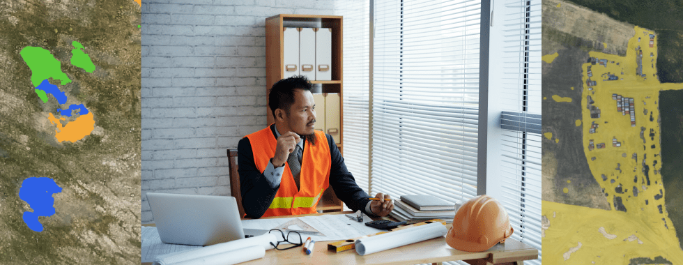
Precision in mapping high-risk zones: The blueprint of safety
Leveraging advanced algorithms and machine learning capabilities, GeoAI precisely pinpoints high-risk zones within mining terrains. By accurately identifying areas prone to instability or potential hazards, mining companies can strategize resource allocation effectively. They can implement targeted safety measures and reduce risks associated with unstable terrains, thereby ensuring a safer working environment for miners.
Moreover, by continuously updating these maps based on real-time data, GeoAI can generate a detailed blueprint of potential hazards within mining sites. This enables mining companies to proactively plan and allocate resources for risk mitigation and prevent potential accidents from occurring.
Predictive maintenance: Avoiding catastrophic failures
Mining equipment experiences heavy wear and tear due to the rugged nature of the job. Regular maintenance is crucial in ensuring operational integrity and preventing catastrophic failures that can cause serious harm to miners. GeoAI’s ability to process large volumes of data allows for predictive maintenance, where potential issues are identified before they develop into critical problems.
By predicting when equipment may fail, mining companies can schedule maintenance in advance, reducing downtime and increasing efficiency. This also ensures the safety of miners by minimizing the risk of unexpected equipment failures.
Improved emergency response: A matter of minutes
In case of an emergency, every minute counts. With GeoAI, mining companies can accurately map out emergency routes and exits within their sites. In addition, real-time data processing allows for quick updates on changing conditions and swift decision-making and response in case of an emergency.
Environmental impact assessment: Preserving the surrounding ecosystem
Mining activities can have a significant impact on the surrounding ecosystem. To minimize this impact, mining companies need to conduct thorough environmental impact assessments (EIA) before starting operations. GeoAI’s ability to generate detailed terrain analysis and maps can greatly aid this process.
By analyzing the terrain and mapping out areas that may be at risk of damage, mining companies can take necessary precautions to prevent environmental degradation. This helps preserve the surrounding ecosystem and ensures sustainable mining practices.
Efficient exploration: Finding new deposits with greater accuracy
Mining companies are constantly searching for new deposits to maintain their operations. With GeoAI, exploration efforts can be significantly improved.
Using advanced algorithms and machine learning, GeoAI can analyze large volumes of geological data and identify areas with potential resources. This dramatically reduces the time and cost involved in traditional methods of exploration. Additionally, the accuracy of results is also increased, leading to better decision-making and more successful exploration efforts.
Challenges and considerations in implementing GeoAI for mining safety
As promising as GeoAI is in transforming mining safety through terrain stability analysis, its integration into mining operations can sometimes pose various challenges and considerations. Some of these include:
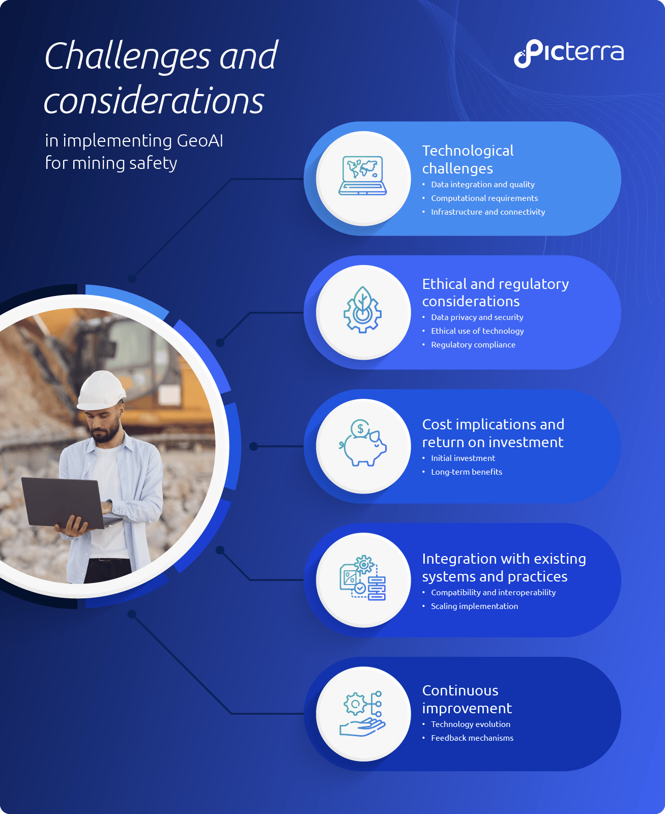
Technological challenges
- Data integration and quality: Discussing the complexities involved in integrating diverse geospatial data sources and ensuring data accuracy and reliability for effective analysis.
- Computational requirements: Exploring the computational demands of processing large volumes of data and running sophisticated machine learning algorithms in near real-time.
- Infrastructure and connectivity: Addressing the necessity for robust infrastructure and network connectivity in remote mining sites to support GeoAI applications.
Ethical and regulatory considerations
- Data privacy and security: Examining the concerns related to data privacy, ownership, and the secure handling of sensitive information.
- Ethical use of technology: Highlighting ethical dilemmas concerning using GeoAI in mining operations, ensuring responsible and transparent implementation.
- Regulatory compliance: Discussing adherence to regulatory frameworks governing data collection, environmental impact assessments, and safety standards in mining.
Cost implications and return on investment
- Initial investment: Analyzing the upfront costs associated with acquiring GeoAI technologies, infrastructure upgrades, and personnel training.
- Long-term benefits: Evaluating the potential return on investment (ROI) regarding enhanced safety, operational efficiency, and environmental sustainability.
Integration with existing systems and practices
- Compatibility and interoperability: Addressing the challenges in integrating GeoAI systems with existing mining infrastructure and operational practices.
- Scaling implementation: Strategies for scaling GeoAI applications across various mining sites and adapting them to diverse terrains and operational contexts.
Continuous improvement and adaptation
- Technology evolution: Highlighting the need for continuous innovation and adaptation to keep pace with advancements in GeoAI technology.
- Feedback mechanisms: Emphasizing the importance of feedback loops and iterative improvements based on real-world data and experiences.
Despite these challenges, implementing GeoAI in mining holds immense potential for enhancing safety and sustainability, including terrain stability analysis. However, it is crucial to ensure responsible and transparent use of this technology, taking into account ethical considerations and regulatory compliance.
GeoAI: Forging a safer and sustainable future in mining operations
As the mining industry continues its evolution, using GeoAI within mining safety stands at the forefront of transformative potential. With advancements in machine learning, computer vision, and data analytics, GeoAI is poised to revolutionize the way we approach terrain stability analysis and overall safety management in mining operations.
Companies like Picterra offer solutions to many of the challenges the mining industry faces, providing robust and user-friendly tools for terrain monitoring and analysis. By leveraging high-resolution satellite imagery and integrating geospatial data with other technologies like AI and IoT, Picterra’s platform offers a comprehensive and customizable solution for mining safety. It’s clear that as we navigate the ever-changing landscape of mining, GeoAI will play a significant and positive role in enhancing safety and sustainability.