In today’s rapidly changing world, sustainability is increasingly woven into the fabric of every industry. One sector that finds itself under scrutiny is mining, a cornerstone of our modern economy yet historically associated with extensive environmental footprints. Now, more than ever, the concept of mining sustainability is critical, seeking not only to minimize environmental impact but also to foster a more harmonious relationship with our planet.
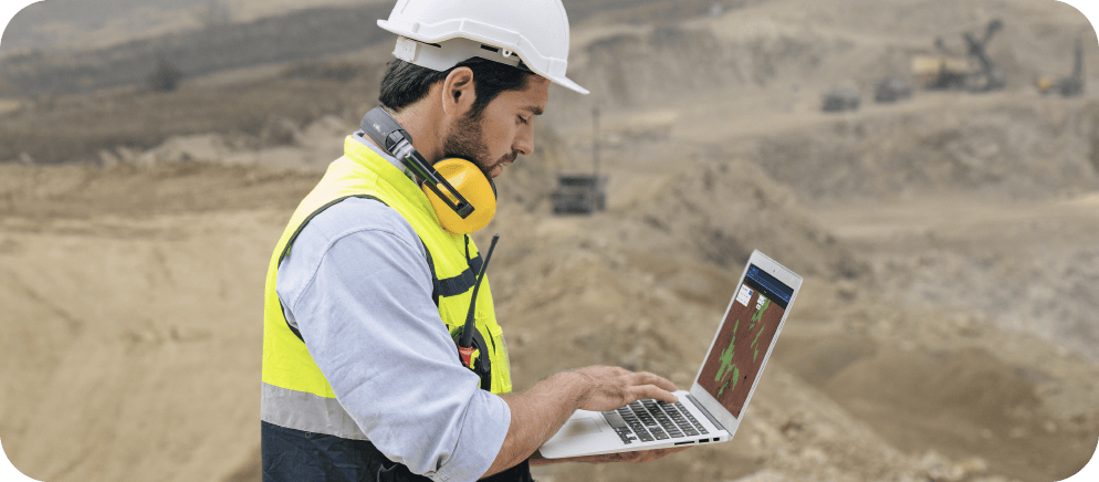
This balance is not achieved without the right tools and technologies—cue geospatial data: a game-changer in our quest for sustainable mining. Geospatial data, often collected through satellite, drone, and aerial imagery, offers a detailed, real-time perspective on our landscapes. Through the lens of this data, and with the help of advanced platforms such as Picterra, which leverages machine learning and artificial intelligence for analysis, we can explore every detail of a mining site.
Understanding terrain features, water sources, air quality, and biodiversity, to name a few, allows us to anticipate and mitigate potential environmental risks better. Thus, we can reduce the environmental footprint of mining operations and contribute to a healthier planet.
In this article, we will journey through the mining industry’s environmental footprint, the urgency of adopting sustainable practices, and how geospatial data can help navigate these challenges. We will also explore the exciting road ahead, filled with innovation, collaboration, and opportunities. Join us as we venture into a future where mining sustainability, powered by geospatial data and technology, becomes a reality.
The environmental footprint of mining
Mining operations play a vital role in our modern lives, providing materials for numerous applications ranging from infrastructure to technology and renewable energy. However, these activities also leave a significant environmental footprint.
Land degradation is a primary concern, resulting from mining-induced alterations such as excavations and removal of topsoil and vegetation. This leads to soil erosion, landscape instability, and ecosystem disruption. Deforestation, often a precursor to mining, further contributes to climate change.
Water pollution, caused by waste products from mining processes, poses another substantial challenge. These effluents can contaminate local water bodies, impacting water quality and aquatic biodiversity. Mining can also reduce groundwater levels, affecting regional water availability.

Want to learn more about how geoAI can be used in mining & quarries?
Air pollution from particulates and greenhouse gases emitted during mining contributes to global warming and poses health risks. Furthermore, mining activities disrupt habitats and animal migration routes, leading to biodiversity loss.
To quantify and mitigate these impacts, various assessment methods and metrics are employed. Environmental Impact Assessments (EIAs) provide a pre-emptive evaluation of potential mining-induced environmental effects, offering mitigation strategies. Monitoring land use changes and water and air quality is also critical, with geospatial data playing a crucial role in these processes.
Geospatial data, derived from satellite, drone, and aerial imagery, provides an overview of mining sites and their environment. This information is instrumental for conducting assessments and informing sustainable mining practices. Sustainability metrics, another step towards reducing mining’s environmental footprint, help measure the effectiveness of such initiatives.
Navigating towards sustainability: The urgent need for sustainable mining practices
Given the significant environmental footprint left by mining activities, the urgency to transition from traditional mining practices to more sustainable methods is growing. The push for sustainable mining is vital not just for environmental reasons but also to ensure the industry’s longevity and preserve our planet’s finite resources.
Sustainable mining practices strive to minimize environmental damage, enhance efficiency, ensure workers’ safety, and promote fairness and benefits for communities affected by mining. This approach balances environmental, economic, and social needs.
Sustainable mining offers numerous benefits, such as efficient resource management and reduced environmental footprint. It mitigates risks associated with land degradation, water and air pollution, and habitat destruction, safeguarding biodiversity. Additionally, it enhances community relations, fostering healthier interactions between the industry and affected communities.
However, the transition to sustainable mining is not without challenges. It necessitates significant investments in new technologies, training, and infrastructure. Ensuring the responsible development and implementation of these new practices is crucial to prevent the introduction of new environmental or social issues.
Transparency and accountability in implementing sustainable practices are also critical. This requirement helps prevent “greenwashing,” where companies falsely portray their environmental responsibility. Robust regulatory frameworks and rigorous monitoring are necessary to maintain the integrity of sustainable mining practices.
Despite these challenges, the transition to sustainable mining is essential. Geospatial data plays a crucial role in this journey, helping mitigate environmental risks, manage resources effectively, and reduce mining operations’ ecological footprint.
Geospatial data: An indispensable tool for mining sustainability
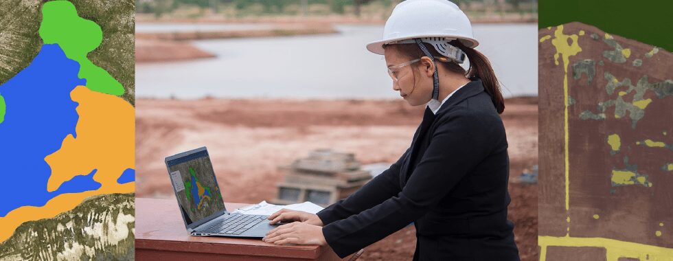
Geospatial data has emerged as an indispensable tool in the journey toward mining sustainability. This technology, harnessed from sources such as satellites, drones, and aerial imagery, is proving instrumental in mitigating environmental challenges and guiding decision-making processes within the mining industry.
Geospatial data offers a wealth of insight into mining sites’ physical characteristics and environmental conditions. Through detailed, real-time, and historical images, we can visualize and comprehend the environmental state of a location, anticipate potential issues, and monitor changes over time. This comprehensive understanding empowers mining operators to plan and execute activities with a clear understanding of their potential environmental impact.
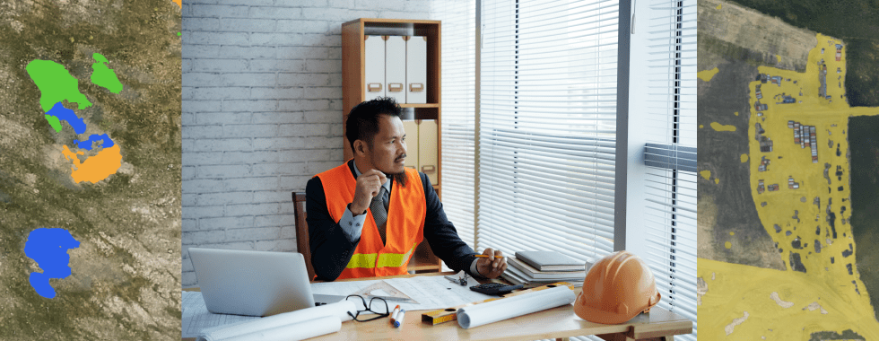
One of the most critical uses of geospatial data is conducting thorough Environmental Impact Assessments (EIAs). By analyzing the spatial data, companies can identify and assess the possible environmental effects of their proposed activities. The insights gained from these assessments provide a baseline for monitoring and mitigation strategies, helping to prevent adverse effects and promote sustainable mining practices.
Geospatial data also enhances decision-making processes. By offering a bird’s-eye view of mining sites and their surrounding areas, geospatial data analytics can guide the planning and operational stages of mining. For example, it can help select mining sites with minimal environmental disruption, design optimal routes for transportation to reduce carbon emissions, and effectively plan land reclamation efforts post-mining.
Furthermore, geospatial data can help identify and address potential risks and hazards. Predictive modeling using geospatial data can forecast the environmental consequences of different mining activities. This forecasting can help avoid water contamination, air pollution, or habitat destruction by implementing mitigating strategies in advance.
Also, during the operational phase, geospatial data can monitor changes in land use, water and air quality, and other environmental parameters, thereby enabling quick responses to potential issues. This real-time monitoring can prevent small problems from escalating into larger environmental crises.
Harnessing geospatial data through platforms like Picterra, which employs machine learning and artificial intelligence for data analysis, further amplifies its benefits. This cutting-edge technology offers high precision and speed, enabling mining companies to gain real-time insights and make proactive decisions.
Overcoming environmental challenges through geospatial innovation
Geospatial innovation stands at the forefront of the mining industry’s drive toward sustainability. Its potential to monitor environmental parameters, reduce emissions, and promote ecological restoration is transforming how mining operations are conducted and perceived.
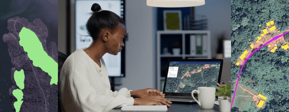
A significant aspect of geospatial data is its ability to effectively monitor land use changes. Through satellite, drone, and aerial imagery, we can track changes in the landscape caused by mining operations in near real time. These insights enable mining companies to manage land use effectively, reducing unnecessary degradation and disruption to local ecosystems. Post-mining, geospatial data can guide the ecological restoration of the site, promoting the rehabilitation of flora and fauna and helping to restore the land to its previous state or repurpose it for new, sustainable uses.
Water quality monitoring is another critical application of geospatial data. Mining operations can lead to water contamination through the release of heavy metals and other pollutants. By continuously monitoring water bodies around mining sites, geospatial data helps identify signs of pollution early, facilitating swift corrective actions. Furthermore, it informs effective water resource management strategies, ensuring the sustainable use of water in mining processes and preserving local water availability.
Air pollution is an unavoidable byproduct of traditional mining operations. However, geospatial data can identify and monitor sources of air pollution, helping to devise strategies to reduce emissions. By incorporating this data, mining operations can invest in cleaner technologies, adjust transport routes to minimize dust emissions, and improve overall air quality.
Geospatial data is also invaluable in managing the mining industry’s carbon footprint. By providing accurate information about fuel consumption and emission levels from mining activities, it can guide efforts to reduce greenhouse gas emissions and improve energy efficiency.
In all these applications, the use of artificial intelligence and machine learning, like on platforms such as Picterra, enhances the accuracy and speed of data analysis. These technologies transform raw geospatial data into actionable insights, helping mining companies to address environmental challenges more effectively.
The road ahead: Challenges, opportunities, and collaboration
Transitioning to sustainable mining practices, powered by geospatial data, poses both challenges and opportunities. Adopting advanced technologies, like Picterra, and collective efforts are key to unlocking geospatial data’s full potential for sustainable mining.
Data availability is a significant challenge. Comprehensive geospatial data collection needs consistent coverage of mining sites and their surroundings, but this can be hindered by geographical and infrastructural constraints and costs.
Collaboration is another challenge. It involves aligning the interests of diverse stakeholders, including mining companies, technology providers like Picterra, environmental groups, governments, and local communities.
However, these hurdles can be surmounted with investments in technological advancements and capacity building. Emerging technologies, such as the Internet of Things (IoT) and cloud computing, promise to enhance data collection, storage, analysis, and sharing, promoting more efficient and transparent mining practices.
Furthermore, the development of more advanced satellite, drone, and aerial imaging technologies, combined with artificial intelligence and machine learning, as seen on the Picterra platform, can enhance predictive modeling, risk assessment, and environmental monitoring capabilities.
Collaborative initiatives are crucial for leveraging geospatial data effectively. Joint efforts between mining companies, governments, local communities, and technology providers are necessary to develop sustainable mining practices. Successful collaborations have already led to innovative solutions for water quality monitoring, land use tracking, and emissions reduction.
Conclusion
The quest for sustainability in mining is no longer an option but a necessity, and geospatial data stands at the forefront of this transformative journey. By harnessing geospatial data from satellite, drone, and aerial imagery, and analyzing it through powerful platforms like Picterra, the mining industry can make significant strides towards reducing its environmental footprint and fostering sustainable practices.
The adoption of geospatial data solutions offers manifold benefits. It enhances environmental monitoring, facilitates efficient resource management, supports robust decision-making, and enables predictive modeling to mitigate risks. It also promotes transparency and accountability, paving the way for responsible and sustainable mining operations.
Through sustainable mining practices, driven by geospatial data, the mining industry holds the potential to bring about significant environmental and social improvements. These include the preservation of landscapes, protection of water and air quality, and reduction of carbon emissions. Furthermore, by adopting sustainable practices, the mining industry can build a more harmonious relationship with local communities, respecting their rights, culture, and natural resources.
The need for collaboration among industry stakeholders is paramount in this context. Mining companies, technology providers, environmental organizations, governments, and local communities all have crucial roles to play. By embracing sustainable mining practices and leveraging the power of geospatial data, we can turn challenges into opportunities, creating a mining sector that harmonizes economic growth with environmental stewardship.