The mining industry is a cornerstone of the global economy, constantly seeking optimization to remain competitive and sustainable in a rapidly evolving landscape. A critical part of this optimization is the ability to accurately understand and manage the vast complexities involved in mineral exploration, extraction, and processing. Enter geospatial data, an unsung hero transforming the face of the mining industry.
Geospatial data refers to information that identifies the geographic location and characteristics of natural or constructed features and boundaries on Earth, ranging from latitudes, longitudes, and altitudes to any other spatial reference. In the context of mining, it plays a pivotal role in every stage of the mining life cycle, from exploration and prospecting, through site selection and planning, to resource estimation, mineral extraction, and production optimization. It also has vital applications in geotechnical and environmental monitoring, ensuring mining operations comply with environmental regulations and maintain sustainability.
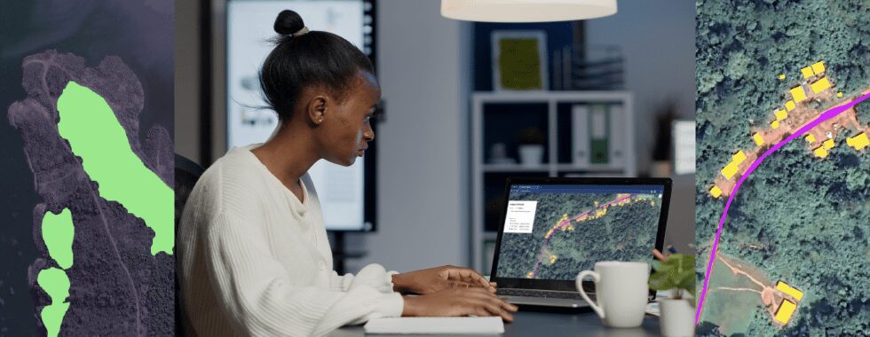
Recent advancements in geospatial technologies, such as Geographic Information Systems (GIS), remote sensing, and satellite imagery, have made it possible to collect, analyze, and visualize geospatial data in ways unimaginable a few decades ago. These technologies enable mining companies to make informed decisions based on accurate, real-time information, minimizing risks and maximizing efficiency.
The power of geospatial data lies in its ability to convert raw, often overwhelming amounts of information into actionable insights. With it, mining operations can uncover hidden patterns, detect anomalies, predict trends, and optimize processes – all contributing to increased profitability and reduced environmental impact.
Through this blog post, we will delve into the role of geospatial data in mining and how it is ushering in a new era of optimization and innovation in the industry. We’ll explore its applications in the various stages of mining operations and look forward to the future, imagining the potential of emerging technologies and the evolving role of geospatial data in the industry.
In essence, geospatial data is not just a game-changer but a strategic asset redefining the mining industry. It’s a treasure map leading to the future of mining, and the journey is just beginning.
The foundation: Understanding geospatial data in mining
Before we delve deeper into the application of geospatial data in mining, it’s essential to understand what it is and where it comes from. At its most basic, geospatial data, also known as spatial data or geographic information, refers to data that is associated with a particular location on the Earth’s surface. This data can be either vector (points, lines, and polygons) or raster (grid cells), and it represents physical locations and features, as well as their spatial relationships and attributes.
In mining, geospatial data is of paramount significance. It provides critical insights into mineral deposits’ geographical distribution, characteristics, terrain, and other environmental features. By leveraging this data, mining companies can make informed decisions about where to explore, where to dig, and how to manage their operations in the most efficient and sustainable manner.
Want to learn more about how geoAI can be used in mining & quarries?
Geospatial data in mining can come from a variety of sources, including:
Satellite Imagery: Satellites orbiting the Earth continuously capture images that provide a wealth of geospatial data. These images can reveal variations in the Earth’s surface composition and structure, hinting at the presence of mineral deposits. Satellite imagery can cover large areas and is particularly useful for initial exploration and broad-scale environmental monitoring.
Aerial Imagery: Aerial photographs taken from aircraft can provide high-resolution geospatial data. These images are often used in the later stages of exploration when a more detailed view of the potential mining area is needed. They can also be invaluable in planning mining operations and monitoring their impact on the surrounding environment.
Drone Imagery: Drones, or Unmanned Aerial Vehicles (UAVs), can capture extremely high-resolution images and are ideal for detailed site inspections and close monitoring of mining activities. They can fly at low altitudes and access areas that are difficult or dangerous for humans to reach, making them a valuable tool in mining.
Ground Surveys: Traditional ground surveys, including geological surveys and soil sampling, provide localized, highly detailed geospatial data. They are often used with remote sensing data to validate findings and gain a more comprehensive understanding of the site.
Geospatial Information Systems (GIS) Data: GIS is a technology that manages, analyzes, and visualizes geospatial data. Data stored in a GIS can come from various sources, including the ones mentioned above, and can be used to create detailed maps and models of the mining area.
In essence, geospatial data, with its diverse sources and types, forms the bedrock of mining operations. Accurately capturing the Earth’s features and spatial relationships provides the critical information needed to optimize every stage of the mining process, from exploration and planning to extraction and closure. It’s the foundation on which successful, sustainable mining operations are built.
The evolving mining landscape: Challenges and opportunities
The mining industry is not static; it continually evolves in response to global trends, economic factors, regulatory changes, societal demands, and technological advancements. Understanding these dynamics is crucial for mining companies to thrive in an ever-changing environment and to address the significant challenges they face.
One of the primary challenges in mining is the increasingly difficult task of exploration and prospecting. High-quality, easily accessible mineral deposits are becoming scarcer, forcing companies to look in more remote and difficult-to-reach places. This not only increases the cost of exploration but also introduces a host of logistical and environmental challenges.
Once a viable mineral deposit is found, accurate resource estimation is another significant hurdle. Misestimations can lead to substantial financial risks and potential project failures. Furthermore, the actual process of mineral extraction is fraught with operational complexities and hazards, requiring meticulous planning and ongoing monitoring to ensure safety and efficiency.
In addition to these operational challenges, mining companies also face mounting pressure to minimize their environmental impact and adhere to increasingly stringent regulatory standards. Geotechnical and environmental monitoring are crucial in this regard, but they can be resource-intensive and difficult to manage effectively.
Despite these challenges, the evolving landscape also presents a wealth of opportunities, particularly in the realm of technology. Emerging technologies, including geospatial technologies, offer innovative solutions to many of the industry’s most pressing problems.
For instance, advanced geospatial technologies, including Geographic Information Systems (GIS), remote sensing, and drone technology, can vastly improve exploration and prospecting by providing detailed, real-time information about the Earth’s surface and subsurface. This can significantly reduce the costs and risks associated with exploration and increase the chances of finding viable mineral deposits.
Furthermore, these technologies can aid in more accurate resource estimation, thereby mitigating financial risks. They can also optimize the planning and execution of mining operations, enhancing productivity and efficiency. And when it comes to environmental monitoring and compliance, geospatial data can provide critical insights into the environmental impact of mining operations and support proactive management strategies.
In essence, the changing landscape of the mining industry poses significant challenges but also opens the door to exciting opportunities. By leveraging the power of geospatial data and other emerging technologies, mining companies can not only navigate these challenges but also optimize their operations in ways that were previously unimaginable. The key lies in recognizing and seizing these opportunities.
Mapping the treasure: Geospatial data applications in mining
Geospatial data is an invaluable tool in the modern mining industry, with a wide range of applications across every stage of the mining life cycle. Let’s take a closer look at how it contributes to optimization in mining operations.
Exploration and prospecting
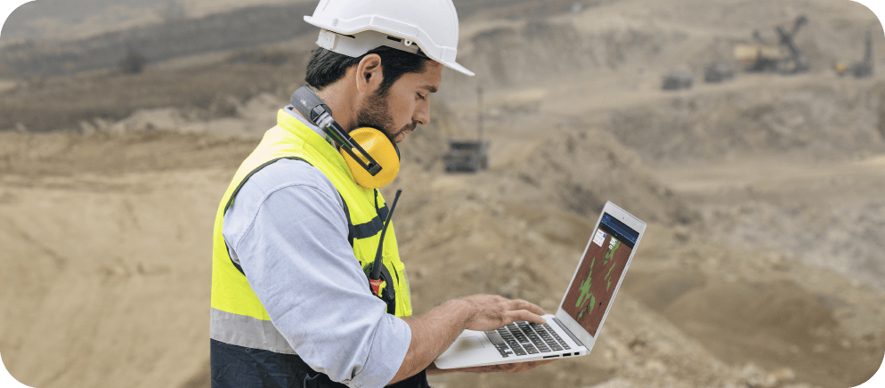
When it comes to exploration, geospatial data is like a treasure map, pointing the way to potential mineral deposits. Advanced geospatial technologies, like satellite and drone imagery, allow for broad-scale to detailed data collection, uncovering the earth’s secrets. Innovative techniques such as spectral analysis can help identify potential targets by detecting anomalies or specific mineral signatures. Moreover, geospatial data can aid in risk assessment by providing insights into factors like terrain difficulty and environmental sensitivities.
Site selection and planning
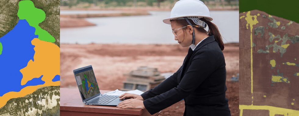
Geospatial data can transform the process of site selection and planning. Providing detailed, real-time information about the geographical and geological characteristics of potential mining sites, allows for informed decision-making. Geospatial data can help assess potential environmental impacts, helping companies mitigate risks before they become problems. It also contributes to enhancing safety and reducing costs by enabling precise planning of mining operations and infrastructure.
Predictive modeling and resource estimation
With geospatial data, mining companies can create predictive models to guide exploration and improve resource estimation. Techniques like geostatistical analysis and machine learning algorithms can analyze patterns in the geospatial data, predicting where mineral deposits are likely to be found and estimating their extent and value. This can significantly reduce the risks and costs associated with exploration and increase the chances of a successful mining operation.
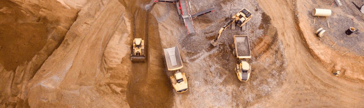
Extraction and production
Once mining begins, geospatial data continues to play a vital role. It provides crucial insights that can optimize mineral extraction, such as the most efficient paths for drilling or blasting. Real-time monitoring of production processes using geospatial data can improve efficiency, productivity, and resource allocation, leading to increased profitability.
Geotechnical monitoring and risk management
Geotechnical monitoring is essential to maintain the stability of the mine and the safety of workers. Geospatial technologies like LiDAR and radar can monitor slope stability and ground movement, providing real-time alerts of potential hazards. This enables mining companies to take preventative action, mitigating risks before they materialize.
Balancing nature and extraction: environmental monitoring and compliance
Finally, geospatial data is crucial in monitoring the environmental impact of mining operations and ensuring compliance with regulatory requirements. It can track changes in the local ecosystem, assess the impact of mining activities, and help develop strategies to minimize and mitigate environmental harm. This not only helps mining companies adhere to regulations but also contributes to sustainable mining practices that balance mineral extraction with environmental stewardship.
The future of mining: Geospatial data and beyond
As we look toward the future, it’s clear that geospatial data will continue to play an integral role in shaping the mining industry. The advancements in geospatial technologies and their integration with other emerging technologies are creating a future where mining operations are safer, more efficient, and more sustainable.
Emerging geospatial technologies, like high-resolution satellite imaging, hyperspectral imaging, and advanced drone technology, promise even greater insights into the Earth’s subsurface. These technologies can detect more subtle variations in the Earth’s surface and provide even more precise data for exploration, prospecting, and monitoring.
Moreover, the integration of geospatial data with other technologies like Artificial Intelligence (AI) and the Internet of Things (IoT) is opening up new frontiers in mining optimization. AI can analyze vast amounts of geospatial data, identify patterns, and make predictions that would be beyond the reach of human analysis. This could further improve resource estimation, predictive modeling, and risk assessment in mining operations.
Similarly, IoT devices, such as sensors installed on mining equipment or throughout a mine site, can generate real-time geospatial data about various operational parameters. This data can be used to monitor and optimize production processes, enhance safety, and reduce environmental impact.
As we look even further into the future, we can envision a mining industry that leverages geospatial data in ways we can only imagine today. For instance, we might see fully autonomous mining operations guided by real-time geospatial data or advanced visualization technologies that enable miners to ‘see’ underground deposits and geological structures in three dimensions. We might also see more sophisticated environmental monitoring systems that use geospatial data to predict and mitigate environmental impacts before they occur.
Final words
Geospatial data is revolutionizing the mining industry. It provides valuable insights that inform decision-making, from exploration and prospecting to extraction and production, fundamentally enhancing efficiency, safety, and sustainability.
The mining landscape is evolving, presenting challenges but also exciting opportunities. Emerging technologies, particularly geospatial technologies and companies like Picterra, offer innovative solutions to many of these challenges and are poised to shape the industry’s future.
Geospatial data is becoming increasingly integrated with other technologies like AI and IoT, heralding a future where mining operations are more optimized than ever. This integration promises a mining industry that is safer, more efficient, and more sustainable.
In summary, geospatial data is a game-changer for the mining industry, a compass guiding us toward a more optimized and sustainable future. As we move forward, it’s clear that the role of geospatial data in mining will continue to grow and shape the industry in profound ways.