As the global demand for resources continues to grow, mining companies face increasing pressure to improve efficiency, minimize environmental impacts, and ensure the safety of their operations.
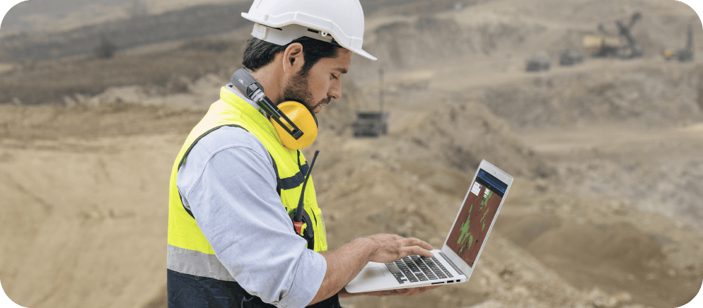
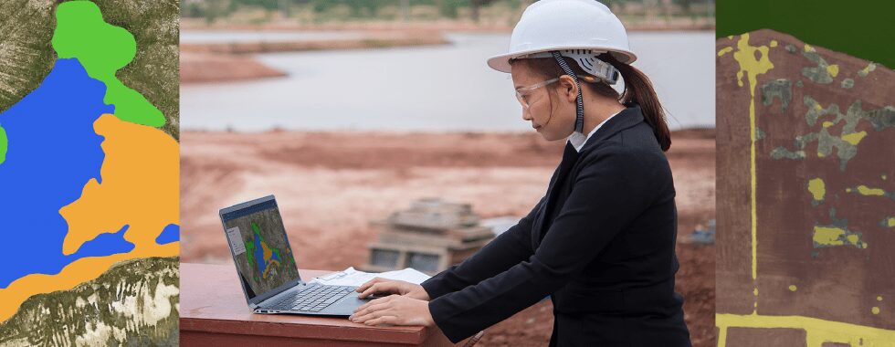
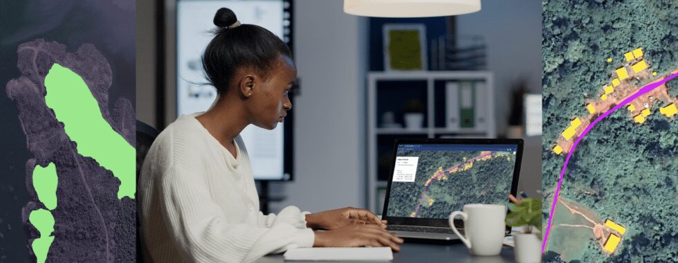
One of the most promising solutions to these challenges is the integration of geospatial intelligence, which combines data from various sources such as satellite and drone imagery to provide comprehensive insights into specific locations. Innovative platforms like Picterra are at the forefront of this transformation, helping mining companies harness the power of geospatial data to mitigate risks and enhance sustainability.
Mitigating environmental risks and enhancing operational safety
The environment, climate change, and competition are some of the main challenges that mining companies are currently facing. Mining operations can harm the environment if they’re not conducted responsibly or efficiently enough. As the world’s appetite for minerals grows, mining companies are taking a more proactive approach to mitigate risks in their operations.
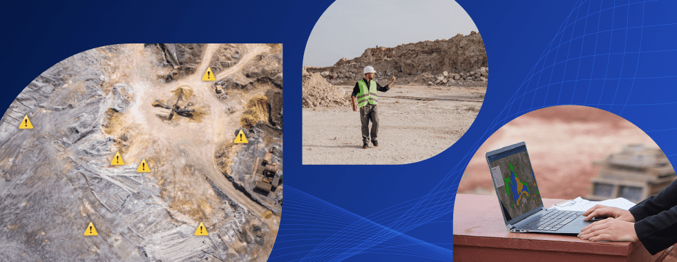
Geospatial intelligence is a technology that combines various types of data, such as satellite and drone imagery, to provide a comprehensive view of a particular location. The use of satellite imagery and other geospatial data can support decision-making processes related to natural resources management, risk management, and planning. In mining, geospatial intelligence can help companies identify potential hazards, such as unstable slopes, water accumulation, and vegetation growth, and take appropriate measures to mitigate them.
One of the primary applications of geospatial intelligence in mining is monitoring environmental conditions. By leveraging satellite and aerial imagery, mining operators can assess the potential environmental consequences of their activities and implement measures to minimize negative impacts on ecosystems and local communities.

Want to learn more about how geoAI can be used in mining & quarries?
Likewise, geospatial intelligence can help mining companies identify the location and condition of resources, such as minerals, water, and energy sources. This information can help companies optimize their use of resources, reduce waste, and improve efficiency. Geospatial intelligence can also help companies monitor their operations and environmental impact, ensuring compliance with regulations and sustainability goals.
Data collected from satellites and drones can be used by engineers to make better decisions about where they should build roads or dig tunnels for them not only work faster but also more safely because they know exactly where everything is located – which means there’s less chance of accidents happening onsite when people aren’t able to see what they’re doing without help from geospatial technology.
Unlocking the potential of machine learning in mining
The combination of artificial intelligence (AI) and machine learning (ML) with geospatial data further advances the capabilities of Earth observation technologies in the mining sector. By processing vast amounts of remote sensing data, AI and ML algorithms can detect patterns and trends that are not easily visible to the human eye, enabling more accurate and timely decision-making. In the context of mining, machine learning algorithms can analyze satellite and drone imagery to identify potential hazards and optimize mining operations.
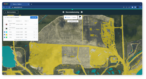
For example, machine learning algorithms can be used to track changes in land use and identify potential hazards. Remote sensing data can be used to monitor surface deformation, detect signs of subsidence or landslides, and evaluate the stability of tailings dams and waste disposal sites. By utilizing platforms like Picterra, mining companies can train custom AI models to automatically detect and classify these features, enabling early intervention and preventing accidents.
This information can then be overlaid with other data sets such as topography maps (elevation) and geological surveys that help determine if there are any risks associated with mining in those specific locations. This can help mining companies take preventive measures, such as reinforcing slopes or redirecting water flow, to mitigate these risks. By identifying and addressing these hazards early on, mining companies can prevent accidents, reduce operational risks, and protect surrounding environments.
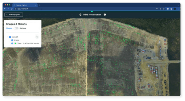
Deforestation is a crucial area where geospatial intelligence can make a significant difference. Satellite imagery can be used to monitor the impact of mining operations on land use, helping companies meet sustainability goals and comply with regulations. In Brazil and Indonesia, for example, satellite data are used by governments and NGOs to detect illegal logging activities. The resulting information is then used by law enforcement agencies as evidence against offenders so they can take action against them.
Deforestation also occurs as a result of mining activities such as an open pit or underground mines because these methods remove large amounts of vegetation from their surroundings over time.
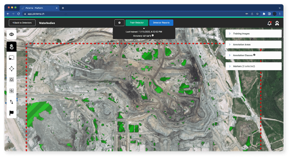
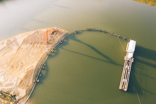
Water management is also essential for sustainable mining practices. Earth observation technologies can help mining operators monitor water resources, assess the effectiveness of water treatment and containment measures, and identify potential contamination sources. Picterra’s geospatial analysis capabilities allow mining companies to efficiently process large volumes of data, ensuring that water quality and scarcity concerns are adequately addressed.
Paving the way for smarter, safer, and more sustainable mining operations
The rapid advancement of AI and geospatial intelligence is entering a new era. By leveraging these technologies, mining companies can gain a comprehensive view of their operations, identify potential hazards, optimize their use of resources, and make informed decisions.
Platforms like Picterra are paving the way for this transformation, offering accessible and powerful tools for mining companies to harness the power of geospatial data and mitigate risks in their operations. As the mining industry evolves, the adoption and integration of geospatial intelligence will play a vital role in promoting sustainable and responsible practices.