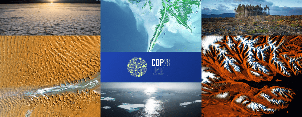
The Expo City in Dubai is set to host the upcoming 28th United Nations Climate Change Conference (commonly known as COP28). This international conference is part of a regular series of global meetings led by the United Nations Framework Convention on Climate Change (UNFCCC) that aims to coordinate efforts to address climate change.
This yearly conference has occurred since the initial UN climate agreement was signed in 1992. Governments worldwide participate in this event to reach agreements on policies to mitigate global temperature rise and adapt to climate change’s various impacts.
What are COP28’s key areas of focus?
Mitigation
- Work to triple renewable energy generation from 8 to 23 TW hours by 2030.
- More than double low-carbon hydrogen production to at least 180 million tons for hard-to-abate sectors.
- Transform food and agriculture systems through greater investment in agri-tech, more innovative water use, and food production in an accelerated time frame.
- Work with the energy industry to accelerate decarbonization, reduce methane and expand hydrogen.
Adaptation
- Protect the most vulnerable communities and critical systems from extreme weather and biodiversity loss.
- Protect the rain forests and invest in nature-based solutions, such as mangroves, which act as powerful carbon sinks while protecting coastlines and preserving natural ecosystems.
- Ensure that our global food system is resilient to the changing weather patterns which threaten farmers around the world.
- Double adaptation finance for the Global South to $40 billion annually by 2025.
Finance
- Require more and need it to be more affordable and accessible.
- Ensure that every concessional dollar is matched by $2 or $3 worth of private capital.
- Answer the call from the international community for an inclusive reform of the multilateral development banks and international financial institutions.
- To encourage this process, the UAE, as chair of the World Bank-IMF Development Committee, intends to play a proactive, supportive, and facilitating role.
Loss and Damage
- Help the most vulnerable to rebuild after climate-related disasters.
- Together with the international community, build on the progress made in Sharm El Sheikh to operationalize the loss-and-damage fund fully.
What role can geospatial play?
Geospatial imagery and tools are essential for understanding, monitoring, planning, and communicating climate change. They provide a powerful means to collect, analyze, and share data that is crucial for climate change action.

- Understanding: Geospatial imagery helps us to understand climate change by providing insights into how the earth’s physical systems are changing over time. This includes data on land cover and use, sea level rise, glacial retreat and ice loss, and other variables such as vegetation health. By analyzing this data, we can better understand how the earth’s climate is changing and how it might change in the future.
- Monitoring: Geospatial imagery is also important for monitoring climate change by providing real-time or near-real-time data on weather patterns, natural disasters, and other events that are influenced by climate change. This data can help scientists and policymakers identify trends and patterns, track changes over time, and make informed decisions about how to respond to climate-related challenges.
- Planning adaptation and mitigation: Geospatial imagery can be used to identify vulnerable areas and populations and to plan adaptation and mitigation strategies to reduce the impact of climate change. This includes data on infrastructure, land use, water resources, and other factors that climate change affects.
- Communicating: Geospatial imagery can be visualized using maps, charts, and other graphics that are easy to understand and can help people to better understand the impacts of climate change. By communicating complex data clearly and concisely, geospatial tools can help to raise awareness about climate change and inspire action.
How does artificial intelligence help?
The use of artificial intelligence (AI) to detect objects, patterns, and changes in geospatial imagery is an increasingly important tool in the fight against climate change. By analyzing large volumes of data from imagery sources (e.g., satellites, drones, and other aerial sources), machine learning algorithms can help to identify and monitor changes in the natural environment, which can provide important insights into the effects of climate change.
One of the key benefits of using AI to analyze EO data is its ability to process and analyze vast amounts of data quickly and accurately. Satellites can produce enormous amounts of data regularly, which would be difficult to process manually. Machine learning algorithms can quickly sift through this data and identify objects, patterns, and changes in the earth’s natural systems, which can help to identify areas that are most at risk from climate change.
For example, AI can be used to identify deforestation in real-time, which is a significant contributor to greenhouse gas emissions. By analyzing satellite imagery and using machine learning algorithms, it is possible to identify areas of forest that have been cleared and track changes in forest cover over time. This can provide valuable insights into the extent and impact of deforestation, which can help policymakers to develop strategies for reducing emissions and protecting forests.
What are some compelling use cases relevant to COP28?
Let’s take a closer look at some of the key areas of focus for COP28 and how geospatial technology leveraging artificial intelligence can have an impact.
Transform food and agriculture systems through greater investment in agri-tech, more innovative water use, and food production in an accelerated time frame.
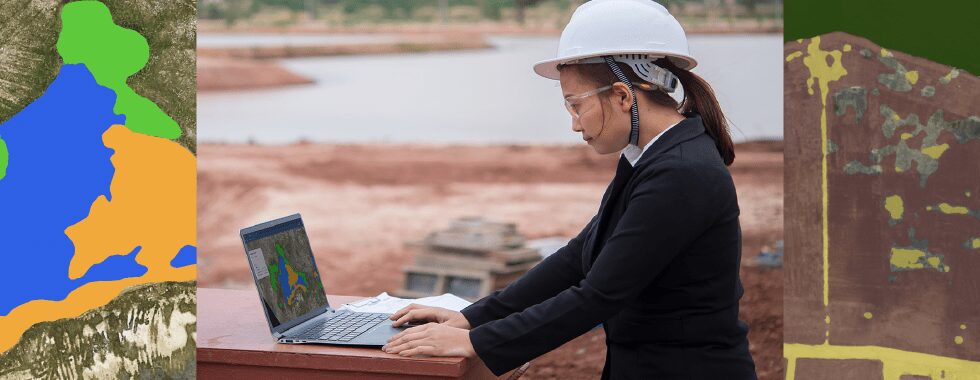
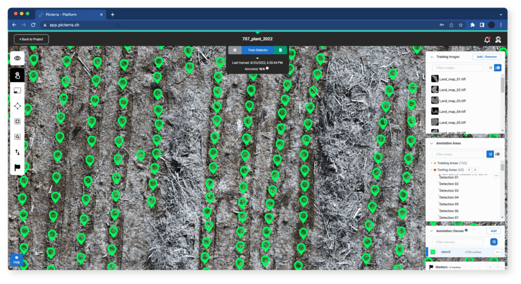
One of the key benefits of analyzing geospatial imagery at scale is its ability to provide a comprehensive view of agricultural land in real-time or near-real-time. This allows farmers to monitor changes over time, identify patterns and trends, and adjust their farming practices accordingly. For example, geospatial imagery can be used to monitor crop health, which can help farmers to identify areas of the field that require more water or nutrients. This can result in more efficient use of resources, reduced waste, and higher crop yields.

Sensand is an agri-tech company building a platform that creates long-term solutions for farmers. They are implementing Picterra like a micro-service inside their platform enabling farmers to autonomously run machine learning models on their data sets and measure their farm-scale environmental improvements. Click here to learn more about how they are helping farmers increase yields and improve efficiency while reducing environmental impact.
Work with the energy industry to accelerate decarbonization, reduce methane and expand hydrogen.
Methane is a potent greenhouse gas that contributes significantly to climate change. Although it is present in much lower concentrations than carbon dioxide in the Earth’s atmosphere, methane is a much more effective heat-trapping gas. In fact, methane is estimated to be 28 times more effective than carbon dioxide at trapping heat over a 100-year timescale.
One of the unique features of the Picterra platform is its support for multispectral and non-visible imagery. This allows users to analyze data from a range of spectral bands that are invisible to the human eye, including the shortwave infrared band. The shortwave infrared band is particularly useful for detecting methane emissions because methane absorbs strongly in this part of the electromagnetic spectrum. By analyzing imagery in the shortwave infrared band, the Picterra platform can detect areas of high methane concentration that would be invisible to the naked eye or other sensors. This can help identify sources of methane emissions to prioritize mitigation efforts and empower accountable parties to implement remedial measures.
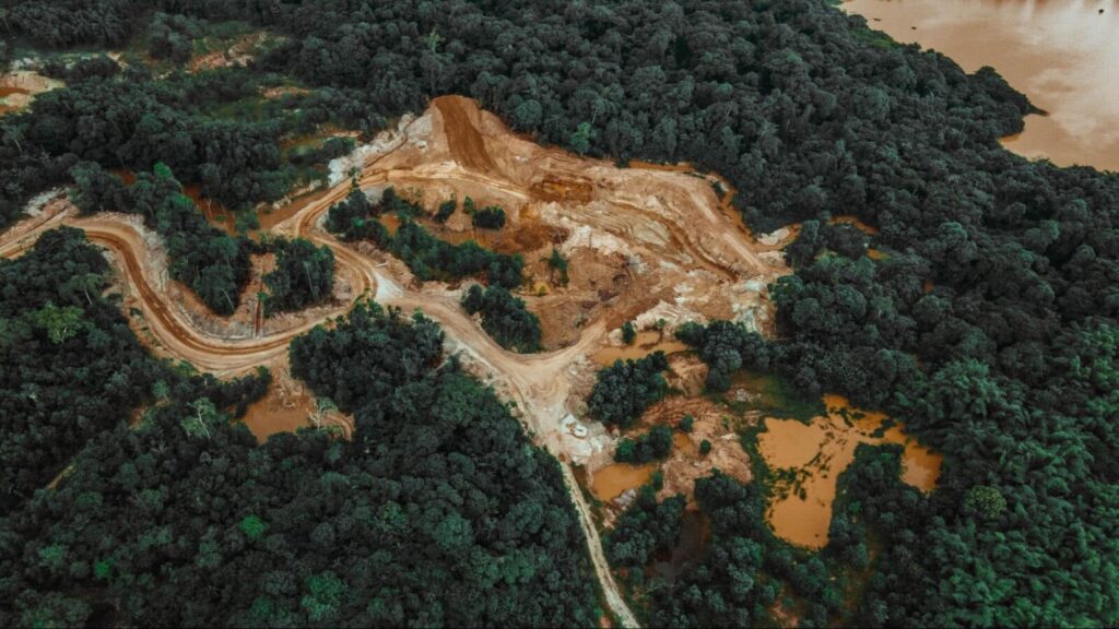
Protect the rain forests and invest in nature-based solutions, such as mangroves, which act as powerful carbon sinks while protecting coastlines and preserving natural ecosystems.
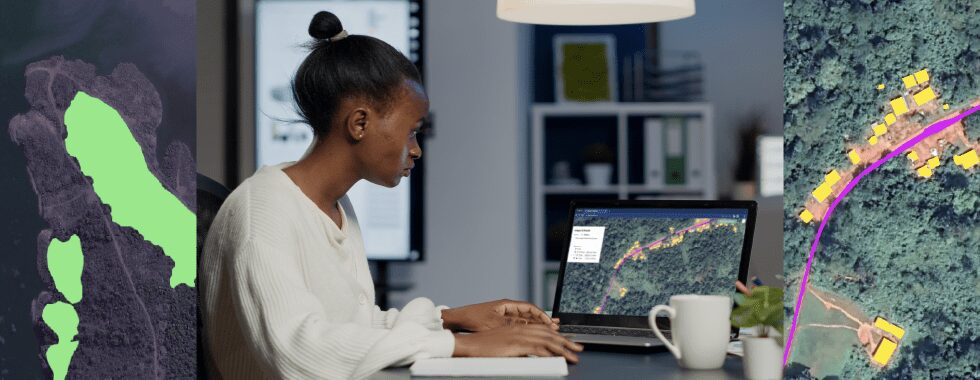
By analyzing satellite imagery, it is possible to identify areas of forest cover loss, which can then be investigated and targeted for conservation efforts. Geospatial imagery can also be used to track illegal logging and mining activities and help to prevent further damage to these important ecosystems.
CIVIS is a geospatial AI service provider that specializes in the remote monitoring and management of forestry. Using Picterra they analyze over 50,000 hectares of forest for some of the largest forestry groups in Latin America. Click here to read more about how they could scale their operations quickly and efficiently resulting in over 15TB of imagery processed by a single user.
Geospatial imagery can be used to monitor and manage coastlines, particularly in areas that are vulnerable to erosion and sea-level rise. By analyzing satellite imagery, it is possible to identify changes in coastal vegetation, dunes, and other landforms that are important for preventing erosion and protecting coastal communities. It can also be used to monitor the impact of coastal development on natural ecosystems and help to identify areas where conservation efforts are needed.

It’s also possible to monitor and manage a wide range of natural ecosystems, including wetlands, coral reefs, and grasslands. By analyzing satellite imagery, it is possible to identify changes in vegetation cover, water levels, and other environmental factors that are important for maintaining ecosystem health.
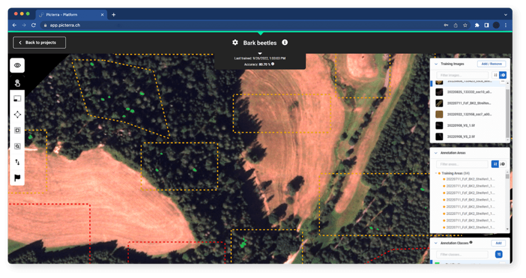
Satellite and drone imagery can also be used to track the spread of invasive species and other threats to biodiversity, allowing for targeted management. Waldstolz uses a combination of satellite imagery and geospatial machine learning to spot early outbreaks of bark beetles across 5,000 hectares of German spruce forest. To date, they’ve prevented 109 bark beetle outbreaks, salvaging over 43,000 trees and preventing 400 tons of extra carbon dioxide in the atmosphere. Click here to read more about their story.
Help the most vulnerable to rebuild after climate-related disasters.
Climate-related disasters, such as floods, hurricanes, and wildfires, can have devastating impacts on communities, especially those that are already vulnerable due to poverty, inequality, and marginalization. EO imagery can be used to assess the extent of damage caused by these disasters, identify areas in need of assistance, and guide reconstruction efforts.
Through the analysis of high-resolution satellite imagery, it is possible to identify areas that have been affected by the disaster and assess the extent of the damage. This information can be used to prioritize relief efforts, target assistance to the most vulnerable communities, and guide the allocation of resources for rebuilding.
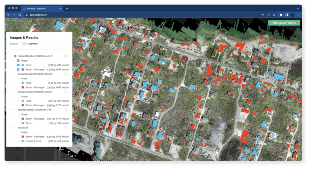
Areas can also be identified that are at high risk of future disasters, such as flood-prone or landslide-prone areas. This information can help communities and governments to plan and prepare for future disasters, taking steps to reduce vulnerability and build resilience. Finally, the effective analysis of such imagery can help to identify key infrastructure and other critical assets that need to be rebuilt or repaired. This can help to ensure that the most important assets are prioritized and that reconstruction efforts are guided by data rather than guesswork.
Conventional cooling, such as air conditioning, is responsible for over seven percent of global greenhouse gas emissions. If not managed properly, energy needs for space cooling will triple by 2050, together with associated emissions.
The development of a Global Cooling Pledge and a “Cool COP Menu of Actions” will also feature prominently at COP28. Sustainable cooling refers to the use of cooling technologies and practices that are energy-efficient, environmentally friendly, and socially responsible. With global temperatures rising and the demand for cooling increases, sustainable cooling has become an important aspect of efforts to mitigate climate change and ensure access to cooling for all, particularly in developing countries.
The urban heat island is a phenomenon where urban areas experience higher temperatures than surrounding rural areas due to the effects of urbanization. As cities grow, they replace natural vegetation and open spaces with buildings, roads, and other infrastructure that absorb and retain heat. This causes temperatures in urban areas to be several degrees higher than those surrounding rural areas, particularly at night.

Green roofs, also known as living roofs or eco-roofs, are a sustainable cooling method that can help to mitigate the urban heat island effect. To identify suitable areas for green roof installation, satellite imagery can be used to analyze the building footprint and surrounding area. By analyzing satellite imagery, it is possible to identify areas that receive high levels of solar radiation and areas that have high levels of impervious surfaces, such as rooftops and parking lots. These areas are particularly suitable for green roof installation, as they can help to mitigate the urban heat island effect and reduce stormwater runoff.
In addition to identifying suitable areas for green roof installation, satellite imagery can also be used to identify existing green roofs. By analyzing high-resolution imagery, it is possible to identify the vegetation cover and other features of green roofs, as well as the size and location of the green roofs. This information can be used to track the growth and impact of green roofs over time, as well as to guide further installation efforts.
Amplifying climate change action at COP28
Picterra, a leading provider of geospatial technology, stands ready to support organizations in the fight against climate change. Our AI-powered platform allows users to extract valuable information from geospatial imagery, such as changes in land use and vegetation health, and to monitor these changes over time. By providing this data, we empower organizations to make informed decisions and take action to reduce their carbon footprint, adapt to the impacts of climate change, and build more sustainable communities.
We are looking forward to COP28, with great anticipation. The conference represents a crucial opportunity for global leaders and organizations to come together and discuss how to address climate change and its impacts. We are committed to being part of the solution and are excited to collaborate with other organizations and governments to make a positive impact in the fight against climate change.