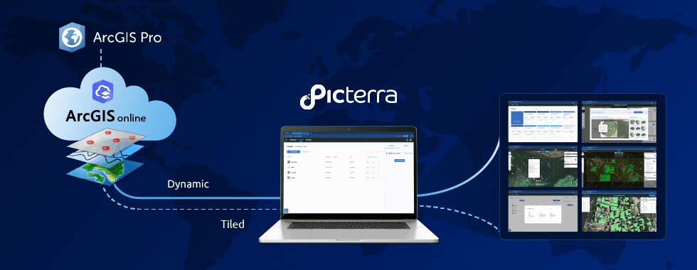
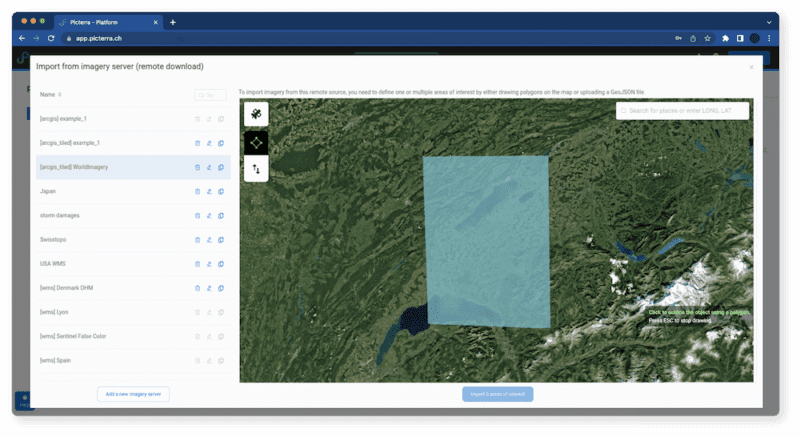

We are excited to announce the expansion of Picterra’s range of supported imagery servers to include Esri’s ArcGIS Image Server! Available via ArcGIS Online, this update aims to provide a more seamless and efficient experience for our users, particularly those with large amounts of data stored on dedicated imagery servers.
At Picterra, we are committed to learning from our users and evolving our platform to better serve their needs. With the latest update to our remote server connection feature, we are pleased to introduce extended support for the ArcGIS Image Server and full compatibility with essential platform features. This update enables improved support for features such as dataset recommendation and advanced tools. Read on to learn more about these updates!
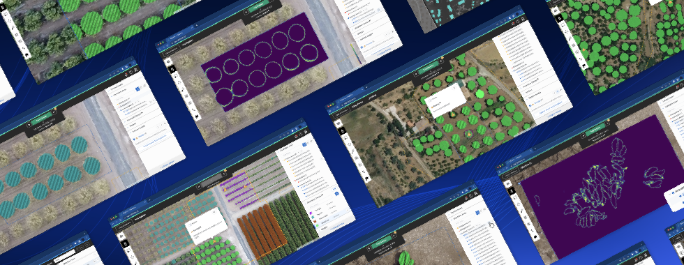
Alongside including support for ArcGIS Image Server we have also improved the overall user experience when working with imagery servers. This ensures better compatibility and functionality with platform features such as dataset recommendation, advanced tools, and our new AI magic wand.
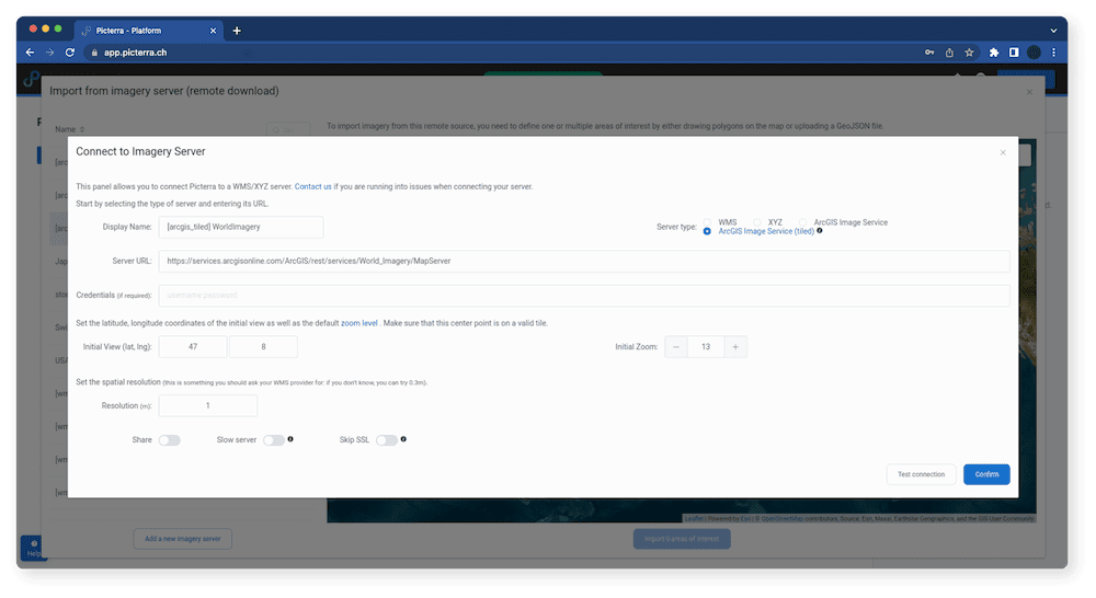
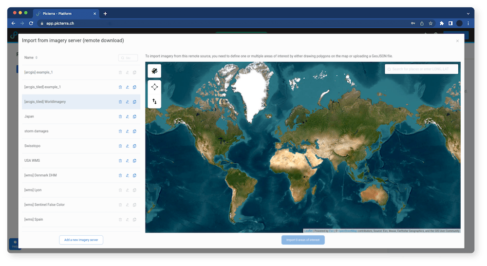
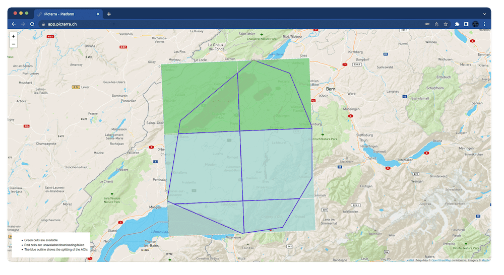
When a user connects to an image server and wants to import an image, they specify the area of interest they want to import. This ensures that if the server is having any issues serving part of the area of interest, this is obvious much earlier in the process since users can also now live track the status of their image import. For more information about how to import imagery from remote imagery servers check out our knowledge base.
This new method will be applied to all new users and will upgrade the traditional approach ensuring data is only imported once thereby significantly improving efficiency.
The expansion of our range of supported servers, including the ArcGIS Image server integration, is a significant step forward, offering enhanced support and features for our users.
Additionally, by improving the user experience, we continue to enhance the platform to provide a more efficient and reliable experience for users.
We are committed to continually improving our platform and providing the best possible experience for our users. If you have any questions or feedback, please do not hesitate to reach out to our team.