Presenting the VITUS project at the "Space Technologies Studies"
Picterra presented the VITUS project in a spotlight session at the “Space Technologies Studies” outcome event. The VITUS project, supported by the Swiss Space Center in the frame of the “Call for Ideas 2017”, investigated the transfer of information between aerial and satellite imagery in order to improve vineyard monitoring.
The project context is Picterra’s main driver: to democratize the access to geo-information. The latest developments in machine learning are integrated to provide our customers with tools efficiently extracting geo-information and trying to bridge the gap between the different sources of EO data. On one hand stands data with a very high spatial resolution such as aerial imagery, on the other hand, data at very high revisit rate coming from satellite constellations. These strengths need to work together.
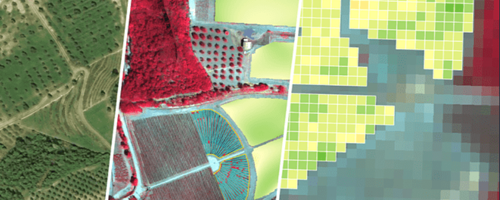
Picterra’s answer to the question “Can we extract information on vineyard plants which are smaller than a Sentinel-2 satellite pixel (10m)?” is a strategy to learn the transfer from aerial to satellite imagery which allows unmixing the spectral information conveyed by Sentinel-2. This enables the monitoring of vineyards at high frequency with a Sentinel-2 image every 5 days. The vine plant vitality retrieved by unmixing improves by 70% the quality of the information derived from Sentinel-2.
This paves the road for a cost-effective monitoring of sub-pixel objects of interests based on free satellite data.